Decatur, Texas
| Decatur, Texas | |
|---|---|
| City | |
|
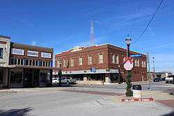
Historic downtown Decatur, Texas | |
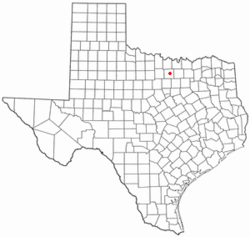 Location of Decatur, Texas | |
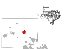 | |
| Coordinates: 33°14′N 97°35′W / 33.233°N 97.583°WCoordinates: 33°14′N 97°35′W / 33.233°N 97.583°W | |
| Country | United States |
| State | Texas |
| County | Wise |
| Area | |
| • Total | 7.0 sq mi (18.0 km2) |
| • Land | 7.0 sq mi (18.0 km2) |
| • Water | 0.0 sq mi (0.0 km2) |
| Elevation | 1,102 ft (336 m) |
| Population (2010)[1] | |
| • Total | 6,042 |
| • Density | 860/sq mi (340/km2) |
| Time zone | Central (CST) (UTC-6) |
| • Summer (DST) | CDT (UTC-5) |
| ZIP code | 76234 |
| Area code(s) | 940 |
| FIPS code | 48-19528[2] |
| GNIS feature ID | 1373362[3] |
| Website | http://www.decaturtx.org/ |
Decatur is a city located in Wise County, Texas, United States. It is the county seat.[4]
Decatur is part of the Dallas–Fort Worth metroplex and is located 25 miles northwest of Fort Worth and 45 miles northwest of Dallas.
The population was 6,042 at the 2010 census.
History
Wise County was established in 1856, and Taylorsville (in honor of Zachary Taylor) was made the county seat.
Absalom Bishop, an early settler and member of the Texas Legislature, opposed naming the town after a Whig Party member, and in 1858 arranged to have the name changed to Decatur, in honor of naval hero Stephen Decatur.
In 1857, a post office was opened, and the first school was established in 1857. In the early 1860s, a courthouse was erected.[5]
Civil War
Early settlers to northern Texas came from a variety of eastern states, and only about half came from the "deep south". As a result, some sympathized with the Unionist side during the Civil War, and violent acts against them were common. One such act occurred in October 1862, when several Unionist sympathizers were arrested and taken to nearby Gainesville for trial on charges of treason and insurrection. Seven of those arrested were hanged, and 14 more were hanged without trial. A few weeks later, more suspected Unionist supporters were hanged without trial in several north Texas communities, including 5 hanged in Decatur. The "Great Hanging at Gainesville" may have been the largest single incident of vigilante violence in U.S. history.[6]
Post-Civil War
By the late 1860s, several stores and a hotel had been established. In 1882, the Fort Worth and Denver Railway reached the town,[5] and Decatur was added to the Butterfield Overland mail route.
In 1864, the Wise County Old Settlers held their first meeting. This has become an annual tradition in Decatur, and the reunion continues to take place during the last full week of July.
Decatur Baptist College (now Dallas Baptist University) was established in Decatur in 1898 and was the first two-year institution of higher education in Texas. In 1965, the college moved to Dallas. The former Administration Building now houses the Wise County Heritage Museum, and is one of five sites in Decatur listed on the National Register of Historic Places.
The Wise County courthouse was designed by James Riely Gordon, the master architect of Texas courthouses. Completed in 1896, the building is an example of Gordon's Signature Plan, using corner entrances (making for short halls) to draw in the breeze, which was pulled up thru a central atrium like a chimney, providing excellent circulation. The exterior is Texas red granite (like the state Capitol) with terra cotta ornamentation. The almost pyramidal mass harks back to 1,000-year-old churches in the south of France. The building has been praised, with its "sister" courthouse in Waxahachie, as "the zenith of Gordon's Richardsonian Romanesque work".[7] It is listed on the National Register.
In 1962, Eddie Wayne Hill, lead guitarist for Tommy & the Tom Toms, and drummer Joel Colbert, were killed when their convertible collided head-on with a gravel truck on state highway 114 south of Decatur. Country singer Charley Pride was more fortunate, surviving a mid-air crash with another plane over Decatur in 1980, though two people died in the crash.[8]
Geography
According to the United States Census Bureau, the city has a total area of 7.0 square miles (18.0 km²). 7.0 square miles (18.0 km²) of it is land and none of the area is covered with water. The highest point of elevation in the county is at the location in Decatur which houses the courthouse. The intent of placing the town on this high point of elevation was to be able to sight and ward off any incoming attacks or raids by Native Americans.
Demographics
| Historical population | |||
|---|---|---|---|
| Census | Pop. | %± | |
| 1880 | 579 | — | |
| 1890 | 1,746 | 201.6% | |
| 1900 | 1,562 | −10.5% | |
| 1910 | 1,651 | 5.7% | |
| 1920 | 2,205 | 33.6% | |
| 1930 | 2,037 | −7.6% | |
| 1940 | 2,578 | 26.6% | |
| 1950 | 2,922 | 13.3% | |
| 1960 | 3,563 | 21.9% | |
| 1970 | 3,240 | −9.1% | |
| 1980 | 4,104 | 26.7% | |
| 1990 | 4,252 | 3.6% | |
| 2000 | 5,201 | 22.3% | |
| 2010 | 6,042 | 16.2% | |
| Est. 2015 | 6,521 | [9] | 7.9% |
As of July 1, 2008, U.S. Census Bureau, the city had estimated population of 6,432.[1]
As of the census[2] of 2000, there were 5,201 people residing in the city. The population density was 747.6 people per square mile (288.5/km²). The racial makeup of the city was 81.64% White, 1.98% African American, 0.58% Native American, 0.73% Asian, 12.44% from other races, and 2.63% from two or more races. Hispanic or Latino of any race were 22.53% of the population.
There are 1,845 households out of which 37.6% have children under the age of 18 living with them, 56.1% are married couples living together, 11.7% have a female householder with no husband present, and 28.5% are non-families. 24.9% of all households are made up of individuals and 12.1% have someone living alone who is 65 years of age or older. The average household size is 2.67 and the average family size is 3.19.
In the city the population is spread out with 17.2% under the age of 18, 20.5% from 18 to 24, 38.1% from 25 to 44, 8.7% from 45 to 64, and 15.5% who are 65 years of age or older. The median age is 34 years. For every 100 females there are 97.3 males. For every 100 females age 18 and over, there are 86.7 males.
The median income for a household in the city was $34,449, and the median income for a family was $40,580. Males had a median income of $30,512 versus $21,213 for females.
Economy
In August 2008, Entegris acquired Poco Graphite, Inc. of Decatur, a supplier of specialized graphite and silicon carbide products for use in semiconductor, EDM, glass bottling, biomedical, aerospace, and alternative energy applications.
Parks and recreation
- Rucker Pond, a reservoir within the Lyndon B. Johnson National Grassland, is located nearby.
- The Sid Richardson Scout Ranch is a Boy Scout camp on Lake Bridgeport, near Decatur.
- Wildwood Naturist's Resort is a family-oriented nudist club in Decatur.
- The Palo Pinto Mountains can be accessed from Decatur.
- Eagle's Canyon Raceway, an auto racing park in Decatur, was included on the 2011 LATAM Challenge Series.
Education
The City of Decatur is served by the Decatur Independent School District (DISD), the largest district in Wise County. Decatur ISD is centered in Decatur and has six campuses: Decatur High School, McCarroll Middle School, Carson Elementary School, Rann Elementary School and Young Elementary. During the 2010-2011 school year, Decatur ISD had 3,011 students enrolled.[11]
Weatherford College has a branch campus in Decatur.
Infrastructure
- The Service Broadcasting Tower Decatur,[12][13] a guyed TV-mast, belongs to world's tallest constructions.
- Decatur Municipal Airport is a city-owned public-use airport located 2 miles north of the central business district.
- Bishop Airport is a privately owned public-use airport located 6 miles east of the central business district of Decatur.
- Lifeteam 68, of the Air Evac Lifeteam air ambulance company, is based at Wise Regional Hospital in Decatur. http://www.air-evac.com/
- The city of Decatur has a full-service, award-winning public library, located at 1700 Hwy. 51 South.
Notable people
- Harley True Burton: historian, college president, Clarendon, Texas mayor
- John E. Hatley: former Master Sergeant in the U.S. Army serving a 40-year sentence in Fort Leavenworth for murdering 4 Iraqi detainees
- Mike Lee: professional bull rider
- James Manness: professional football player
- Joseph Fort Newton: minister, author
- Tom Pickett: 19th-century cowboy, professional gambler, lawman, outlaw
- William Raborn: Director of the Central Intelligence Agency
- Texas Ruby: country music singer
- Phil Ryan: Texas Ranger, 3-term Wise County sheriff
- Samuel M. Sampler: recipient of America's highest military award—the Medal of Honor—for his actions during World War I
- Tommy Tatum: professional baseball player
- Guinn Williams: U.S. Representative from Texas
- Guinn "Big Boy" Williams: Western movie star
In popular culture
- "Eighter from Decatur" is a slang phrase used by craps shooters who want to roll an eight as well as the title of a song (minus the "e" in eighter) by Western Swing legend Bob Wills. In 1949, Decatur mayor Sly Hardwick added the phrase to two signs welcoming tourists to the town.[14]
Climate
The climate in this area is characterized by hot, humid summers and generally mild to cool winters. According to the Köppen climate classification system, Decatur has a humid subtropical climate, abbreviated "Cfa" on climate maps.[15]
References
- 1 2 "Table 4: Annual Estimates of the Resident Population for Incorporated Places in Texas, Listed Alphabetically: April 1, 2000 to July 1, 2008" (CSV). United States Census Bureau, Population Division. 2009-07-01. Retrieved 2010-05-04.
- 1 2 "American FactFinder". United States Census Bureau. Archived from the original on 2013-09-11. Retrieved 2008-01-31.
- ↑ "US Board on Geographic Names". United States Geological Survey. 2007-10-25. Retrieved 2008-01-31.
- ↑ "Find a County". National Association of Counties. Archived from the original on 2011-05-31. Retrieved 2011-06-07.
- 1 2 Barton, Jim Tom. "DECATUR, TX". Handbook of Texas Online. Texas State Historical Association.
- ↑ "Under the Rebel Flag: Life in Texas During the Civil War". Texas State Library and Archives Commission. 2011.
- ↑ Meister, Chris (2011). James Riely Gordon: His Courthouses and Other Public Architecture. Lubbock, TX: Texas Tech University Press. ISBN 978-0-89672-691-8.
- ↑ "Charlie Pride Survives Midair Crash; 2 Die". Milwaulkee Sentinel. August 7, 1980.
- ↑ "Annual Estimates of the Resident Population for Incorporated Places: April 1, 2010 to July 1, 2015". Retrieved July 2, 2016.
- ↑ "Census of Population and Housing". Census.gov. Archived from the original on May 11, 2015. Retrieved June 4, 2015.
- ↑ "Decatur Isd". U.S. Department of Education.
- ↑ Service Broadcasting Tower retrieved May 19, 2007
- ↑ Antenna Structure Registration #1040339 retrieved May 19, 2007
- ↑ "Mayor Makes his Point: 'Eighter from Decatur' Signs to Greet Tourists". Miami News. July 19, 1949.
- ↑ Climate Summary for Decatur, Texas
External links
- City of Decatur - Official Website
- Decatur Chamber of Commerce
- Decatur Independent School District
| Wikimedia Commons has media related to Decatur, Texas. |
Municipalities and communities of Wise County, Texas, United States | ||
|---|---|---|
| Cities |  | |
| Towns | ||
| CDPs | ||
| Unincorporated communities | ||
| Ghost town |
| |
| Footnotes | ‡This populated place also has portions in an adjacent county or counties | |