Salisbury Island (Nunavut)
This article is about the island in Canada. For other islands, see Salisbury Island.
|
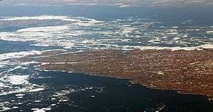
Salisbury Island, Nunavut, June 25, 2014 | |
 Salisbury Island | |
| Geography | |
|---|---|
| Location | Hudson Strait |
| Coordinates | 63°35′N 77°00′W / 63.583°N 77.000°WCoordinates: 63°35′N 77°00′W / 63.583°N 77.000°W |
| Area | 804 km2 (310 sq mi) |
| Coastline | 278 km (172.7 mi) |
| Administration | |
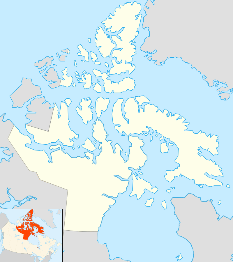
| Territory | Nunavut |
| Region | Qikiqtaaluk |
| Additional information | |
| Source: Salisbury Island at Atlas of Canada | |
Salisbury Island is one of the uninhabited Canadian arctic islands in the Qikiqtaaluk Region, Nunavut. It is located in Hudson Strait, and has an area of 804 km2 (310 sq mi).[1]
References
- ↑ Salisbury Island at Atlas of Canada
This article is issued from Wikipedia - version of the 11/27/2016. The text is available under the Creative Commons Attribution/Share Alike but additional terms may apply for the media files.