Shamlugh
Coordinates: 41°10′05″N 44°42′27″E / 41.16806°N 44.70750°E
| Shamlugh Շամլուղ | |
|---|---|
|
Shamlugh | |
 Shamlugh | |
| Coordinates: 41°10′05″N 44°42′27″E / 41.16806°N 44.70750°E | |
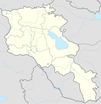
| Country | Armenia |
| Marz (Province) | Lori |
| Founded | 1770 |
| Government | |
| • Mayor | Lendrush Bejanyan |
| Area | |
| • Total | 3.6 km2 (1.4 sq mi) |
| Elevation | 810 m (2,660 ft) |
| Population (2011 census) | |
| • Total | 700 |
| • Density | 190/km2 (500/sq mi) |
| Time zone | (UTC+4) |
| Sources: Population[1] | |
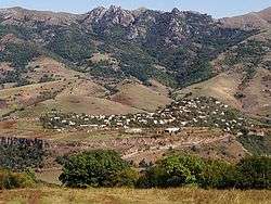
Shamlugh (Armenian: Շամլուղ), is a town located in the Lori Province of Armenia. It is situated on the left bank of Debed River, 196 km north of the capital Yerevan and 63 km north of the provincial centre Vanadzor. It covers an area of 3.6 km² just 7 km west of the Vanadzor-Tbilisi highway, with only 700 inhabitants as of the 2011 census.
Shamlugh used to be a village until 1938 when it was turned into an urban community. In 1995 the government of independent Armenia reaffirmed the status of Shamlugh as a city. During the 1995 reform, the small communities of Bendik, Bughakar and Verin Akhtala were merged within the town of Shamlugh.
History
During the 19th century, Sahmlugh was part of Borchalu region of Tiflis governorate under the Russian rule. The settlement used to bear the names of Shamlug, Samblud, Shamblugh and then Shamlugh.
Copper mining became popular in the region at the 2nd half of the 18th century, when Greek miners from Gyumushkhane migrated to the area and built a copper factory in 1770, thus stimulating for the gradual development of the whole region and setting the ground for the foundation of Shamlugh settlement at the end of the 18th century (settled originally by ethnic Greeks).[2]
The population of Shamlugh reached up to 4,000 inhabitants during the latest years of the Soviet rule. The majority of the community used to consist of Greeks and Azerbaijanis. During the conflicts of 1988-1989 most Azerbaijanis migrated to the Republic of Azerbaijan.[3] Most ethnic Greeks had also left the town as a result of the bad economical conditions.
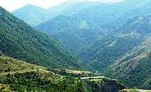
Surrounded with thick forests and meadows, Shamlugh has a subtropical climate, with dry cool summers and mild winters. The annual precipitation is ranged between 500-600 mm. From agro-climate point of view it is in intensive irrigation zone.
The economy of the town is mainly based on the mining plant which is owned by "Metal Prince" company. Approximately 10% of the population are working in the copper plant. On the other hand, a considerable number of the inhabitants are involved in agriculture and cattle-breeding activities. There are reserves of clay as well, which are being utilized for industrial uses.
Shamlugh has only one public education school and a single nursery school. At present, the town is suffering from its extremely bad infrastructure. The community has problems with the renovation of the old school building, the reconstruction of the ravaged intercommunity roads and the modernization of the devastated sewage system and drinking water pipes.
A Bronze age cemetery site and a 13th-century cross-stone complex are preserved in Shamlugh.