Shire of Ashburton
| Shire of Ashburton Western Australia | |||||||||||||
|---|---|---|---|---|---|---|---|---|---|---|---|---|---|
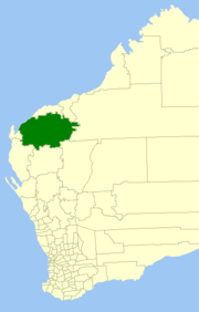 Location in Western Australia | |||||||||||||
| Population | 10,959 (2013 est)[1] | ||||||||||||
| • Density | 0.103732/km2 (0.268665/sq mi) | ||||||||||||
| Established | 1972 | ||||||||||||
| Area | 105,647 km2 (40,790.5 sq mi) | ||||||||||||
| Mayor | Kerry White | ||||||||||||
| Council seat | Tom Price | ||||||||||||
| Region | Pilbara | ||||||||||||
| State electorate(s) | North West Central | ||||||||||||
| Federal Division(s) | Durack | ||||||||||||
|
| |||||||||||||
| Website | Shire of Ashburton | ||||||||||||
| |||||||||||||
The Shire of Ashburton is one of the four local government areas in the Pilbara region of Western Australia, covering an area of 105,647 square kilometres (40,791 sq mi). The Shire's administration centre is in the town of Tom Price. It has a population of about 10,959 (April 2014), most of whom live in the mining towns or in nearby mining camps.
Most of the land in Ashburton is taken up by pastoral leases. Other industries important to Ashburton include iron ore mining, oil, natural gas, fishing and tourism. Ashburton also contains the Karijini National Park.
Climate
The climate of Ashburton is dry and very hot. Mean maximum daily temperatures range from 24 °C (75 °F) in July to 41 °C (106 °F) in January. Average annual rainfall is just 280 millimetres (11 in), but can vary from less than 25 millimetres (1 in) to almost 1,000 millimetres (40 in) in years when several cyclones hit.
History
The Shire has its origins in two early road districts: Ashburton (1887), based in Onslow, and Tableland (1896), based in the Hamersley Range. Both became shires on 1 July 1961 under the Local Government Act 1960.
On 27 May 1972 the two merged to form the Shire of West Pilbara, which was renamed the Shire of Ashburton in December 1987.[2]
The name was changed to provide more identity to the particular region and to discriminate from the Newman region, which is also referred to as the "West Pilbara".
The Ashburton River runs through the lower portion of the region.
It was decided to move the administration office from Onslow to the more centrally located town of Tom Price in January 1990, when the Shire's administration office was officially opened in Poinciana Street.
Wards
The Shire is divided into 6 Wards, 9 Councillors in total.
- Tom Price (3 Councillors)
- Paraburdoo (2 Councillors)
- Ashburton (1 Councillor)
- Onslow (1 Councillor)
- Pannawonica (1 Councillor)
- Tableland (1 Councillor)
Towns
- Tom Price, the administrative centre
- Paraburdoo
- Onslow
- Pannawonica
References
- ↑ "3218.0 Regional Population Growth, Australia. Table 5. Estimated Resident Population, Local Government Areas, Western Australia". 3 April 2014. Retrieved 11 September 2014.
- ↑ WA Electoral Commission, Municipality Boundary Amendments Register (release 3.0), 31 May 2007.
Further reading
- (1993) Ashburton Shire - brief history, named Shire of Ashburton 18 Dec. 1987 with the main offices in Tom Price, crest described Shire of Ashburton directory, 1993, p. 13
External links
Coordinates: 22°41′38″S 117°47′42″E / 22.694°S 117.795°E