Shire of Three Springs
| Shire of Three Springs Western Australia | |||||||||||||
|---|---|---|---|---|---|---|---|---|---|---|---|---|---|
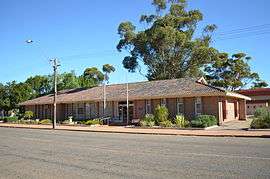 Three Springs shire office, 2013 | |||||||||||||
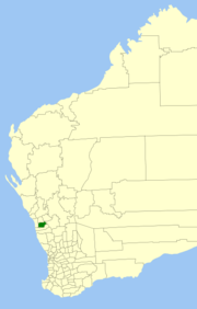 Location in Western Australia | |||||||||||||
| Population | 632 (2013 est)[1] | ||||||||||||
| • Density | 0.23783/km2 (0.6160/sq mi) | ||||||||||||
| Area | 2,657.4 km2 (1,026.0 sq mi) | ||||||||||||
| President | Anthony Thomas | ||||||||||||
| Council seat | Three Springs | ||||||||||||
| Region | Mid West | ||||||||||||
| State electorate(s) | Moore | ||||||||||||
| Federal Division(s) | Durack | ||||||||||||
| Website | Shire of Three Springs | ||||||||||||
| |||||||||||||
The Shire of Three Springs is a local government area in the Mid West region of Western Australia, about 310 kilometres (193 mi) north of the state capital, Perth. The Shire covers an area of 2,657 square kilometres (1,026 sq mi), and its seat of government is the town of Three Springs.
History
The Three Springs Road District was constituted on 2 November 1928 from parts of the neighbouring districts of Mingenew, Perenjori and Carnamah. It held its first meeting on 2 February 1929, with E. Hunt as its first chairman. On 1 July 1961, it became a shire under the Local Government Act 1960.[2]
On 18 September 2009, the Shires of Mingenew, Three Springs, Morawa and Perenjori announced their intention to amalgamate. A formal agreement was signed five days later, and the name Billeranga was later chosen.[3]
However, by February 2011, community pressure had led to the negotiations stalling, and on 16 April 2011, voters from the Shire of Perenjori defeated the proposal at a referendum.[4][5]
Wards
The Shire is no longer divided into wards. The seven councillors represent all electors.
Towns and localities
- Three Springs
- Arrino
- Dudawa
- Kadathinni
- Womarden
Population
| Year | Population |
|---|---|
| 1933 | 879 |
| 1947 | 730 |
| 1954 | 972 |
| 1961 | 1,018 |
| 1966 | 1,038 |
| 1971 | 1,011 |
| 1976 | 1,064 |
| 1981 | 1,081 |
| 1986 | 1,022 |
| 1991 | 820 |
| 1996 | 806 |
| 2001 | 732 |
| 2006 | 664 |
References
- ↑ "3218.0 Regional Population Growth, Australia. Table 5. Estimated Resident Population, Local Government Areas, Western Australia". 3 April 2014. Retrieved 11 September 2014.
- ↑ WA Electoral Commission, Municipality Boundary Amendments Register (release 3.0), 31 May 2007.
- ↑ "Mid-West councils to amalgamate". ABC Online. 18 September 2009.
- ↑ Kennedy, Jane (25 February 2011). "Shire merges hit stalling point". ABC Midwest. Retrieved 26 May 2012.
- ↑ "Perenjori amalgamation not to proceed". Mid West News. 18 April 2011. Retrieved 26 May 2012.
External links
- Official website
- Early History of Three Springs
- Three Springs Cemetery
- Biographical Dictionary of Coorow, Carnamah and Three Springs
Coordinates: 29°31′59″S 115°42′53″E / 29.53306°S 115.71472°E