Shire of Cuballing
| Shire of Cuballing Western Australia | |||||||||||||
|---|---|---|---|---|---|---|---|---|---|---|---|---|---|
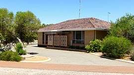 Cuballing shire offices, 2014 | |||||||||||||
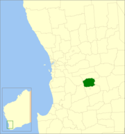 Location in Western Australia | |||||||||||||
| Population | 878 (2013)[1] | ||||||||||||
| • Density | 0.7345/km2 (1.9023/sq mi) | ||||||||||||
| Established | 1902 | ||||||||||||
| Area | 1,195.4 km2 (461.5 sq mi) | ||||||||||||
| Mayor | Mark Conley | ||||||||||||
| Council seat | Cuballing | ||||||||||||
| Region | Wheatbelt | ||||||||||||
| State electorate(s) | Wagin | ||||||||||||
| Federal Division(s) | O'Connor | ||||||||||||
|
| |||||||||||||
| Website | Shire of Cuballing | ||||||||||||
| |||||||||||||
The Shire of Cuballing is a local government area located in the Wheatbelt region of Western Australia. Cuballing is located 15.1 kilometres (9 mi) north of the town of Narrogin and 192 kilometres (119 mi) southeast of the capital, Perth. The Shire covers an area of 1,195 square kilometres (461 sq mi) and its seat of government is the small town of Cuballing.
Over 10% of its area contains native dryandra forests. The economy, worth approximately $20 million per year to the state economy, is based on agriculture, with cereal grains, sheep and pig farming being the main activities[2]
History
On 31 October 1902, the Cuballing Road District was created. On 1 July 1961, it became a shire following the enactment of the Local Government Act 1960.[3]
Wards
On 3 May 2003, the shire was divided into two wards.[3]
- North Ward (three councillors)
- South Ward (four councillors)
Between 1912 and 2003, the ward names were as follows:[4]
- Cuballing Ward
- North West Ward
- North East Ward
- Central West Ward
- Central East Ward
- South West Ward
- South East Ward
Towns and localities
- Cuballing
- Contine
- Popanyinning
- Yornaning
Population
| Year | Population |
|---|---|
| 1911 | 1060 |
| 1921 | 930 |
| 1933 | 849 |
| 1947 | 677 |
| 1954 | 890 |
| 1961 | 833 |
| 1966 | 732 |
| 1971 | 663 |
| 1976 | 622 |
| 1981 | 680 |
| 1986 | 636 |
| 1991 | 717 |
| 1996 | 708 |
| 2001 | 685 |
| 2006 | 779 |
References
- ↑ "3218.0 Regional Population Growth, Australia. Table 5. Estimated Resident Population, Local Government Areas, Western Australia". 3 April 2014. Retrieved 11 September 2014.
- ↑ Agriculture WA (July 2000). "Agriculture Statistical Overview 96/97 - Shire of Cuballing" (PDF). Archived from the original (PDF) on 2006-09-17. Retrieved 2006-11-15.
- 1 2 WA Electoral Commission, Municipality Boundary Amendments Register (release 3.0), 31 July 2007.
- ↑ "Local Government Act 1960 - Shire of Cuballing (Ward Boundaries) Order No.1 1987". Western Australia Government Gazette. 11 December 1987. p. 1987:4406.
External links
Coordinates: 32°49′12″S 117°10′52″E / 32.820°S 117.181°E