Shire of Kojonup
This article is about a local government area. For the town, see Kojonup, Western Australia.
| Shire of Kojonup Western Australia | |||||||||||||
|---|---|---|---|---|---|---|---|---|---|---|---|---|---|
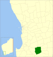 Location in Western Australia | |||||||||||||
| Population | 2,022 (2013 est)[1] | ||||||||||||
| • Density | 0.68958/km2 (1.7860/sq mi) | ||||||||||||
| Established | 1871 | ||||||||||||
| Area | 2,932.2 km2 (1,132.1 sq mi) | ||||||||||||
| Mayor | Jane Trethowan | ||||||||||||
| Council seat | Kojonup | ||||||||||||
| Region | Great Southern | ||||||||||||
| State electorate(s) | Wagin | ||||||||||||
| Federal Division(s) | O'Connor | ||||||||||||
|
| |||||||||||||
| Website | Shire of Kojonup | ||||||||||||
| |||||||||||||
The Shire of Kojonup is a local government area in the Great Southern region of Western Australia, about 250 kilometres (155 mi) southeast of the state capital, Perth, along Albany Highway. The Shire covers an area of 2,932 square kilometres (1,132 sq mi) and its seat of government is the town of Kojonup.
History
The Kojonup Road District was created in 1871. On 1 July 1961, it became the Shire of Kojonup under the Local Government Act 1960.[2]
Wards
The shire has no wards, and all councillors serve 4-year terms. Previously, it was divided into 5 wards:
- Kojonup Ward (3 councillors)
- Balgarup Ward (2 councillors)
- Muradup Ward (2 councillors)
- Ongerup Ward (2 councillors)
- Namarillup Ward (2 councillors)
(Note: The town of Ongerup, unrelated to the ward, is located within the Shire of Gnowangerup.)
Towns and localities
References
- ↑ "3218.0 Regional Population Growth, Australia. Table 5. Estimated Resident Population, Local Government Areas, Western Australia". 3 April 2014. Retrieved 11 September 2014.
- ↑ WA Electoral Commission, Municipality Boundary Amendments Register (release 3.0), 31 May 2007.
External links
Coordinates: 33°50′17″S 117°09′07″E / 33.838°S 117.152°E
This article is issued from Wikipedia - version of the 11/9/2016. The text is available under the Creative Commons Attribution/Share Alike but additional terms may apply for the media files.