Canaan, Connecticut
| Town of Canaan | ||
|---|---|---|
| Town | ||
| ||
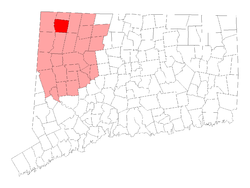 Location in Litchfield County, Connecticut | ||
| Coordinates: 41°57′42″N 73°18′30″W / 41.96167°N 73.30833°WCoordinates: 41°57′42″N 73°18′30″W / 41.96167°N 73.30833°W | ||
| Country | United States | |
| State | Connecticut | |
| NECTA | Torrington, CT | |
| Region | Northwestern Connecticut | |
| Incorporated | 1739 | |
| Government | ||
| • Type | Selectman-town meeting | |
| • First selectman | Patricia Allyn Mechare (D) | |
| • Selectman | Charles H. Lewis (D) | |
| • Selectman | Greg Marlowe (R) | |
| Area | ||
| • Total | 33.3 sq mi (86.2 km2) | |
| • Land | 32.9 sq mi (85.3 km2) | |
| • Water | 0.3 sq mi (0.9 km2) | |
| Elevation | 656 ft (200 m) | |
| Population (2005) | ||
| • Total | 1,101 | |
| • Density | 33/sq mi (13/km2) | |
| Time zone | EST (UTC-5) | |
| • Summer (DST) | EDT (UTC-4) | |
| ZIP code | 06031 | |
| Area code(s) | 860 | |
| FIPS code | 09-10940 | |
| GNIS feature ID | 0213402 | |
| Website |
www | |

Canaan is a town in Litchfield County, Connecticut, United States. The population was 1,081 at the 2000 census. The town of Canaan is often referred to locally by the name of its principal constituent village, Falls Village.[1]
Geography
According to the United States Census Bureau, the town has a total area of 33.3 square miles (86.2 km²), of which 33.0 square miles (85.3 km²) is land and 0.3 square mile (0.9 km²) (0.99%) is water.
History
American Revolutionary War soldier and historian Lemuel Roberts was born in Canaan in 1755.[2]
Principal communities
- Falls Village (town center)
- Huntsville
- Lower City
- South Canaan
Demographics
| Historical population | |||
|---|---|---|---|
| Census | Pop. | %± | |
| 1820 | 2,332 | — | |
| 1850 | 2,627 | — | |
| 1860 | 1,408 | −46.4% | |
| 1870 | 1,257 | −10.7% | |
| 1880 | 1,157 | −8.0% | |
| 1890 | 970 | −16.2% | |
| 1900 | 820 | −15.5% | |
| 1910 | 702 | −14.4% | |
| 1920 | 561 | −20.1% | |
| 1930 | 565 | 0.7% | |
| 1940 | 555 | −1.8% | |
| 1950 | 708 | 27.6% | |
| 1960 | 790 | 11.6% | |
| 1970 | 931 | 17.8% | |
| 1980 | 1,002 | 7.6% | |
| 1990 | 1,057 | 5.5% | |
| 2000 | 1,081 | 2.3% | |
| 2010 | 1,234 | 14.2% | |
| Est. 2014 | 1,195 | [3] | −3.2% |
As of the census[5] of 2000, there were 1,081 people, 445 households, and 298 families residing in the town. The population density was 32.8 people per square mile (12.7/km²). There were 610 housing units at an average density of 18.5 per square mile (7.1/km²). The racial makeup of the town was 97.04% White, 1.48% Black or African American, 0.19% Asian, 0.09% Pacific Islander, 0.37% from other races, and 0.83% from two or more races. Hispanic or Latino of any race were 0.37% of the population.
There were 445 households out of which 30.3% had children under the age of 18 living with them, 57.8% were married couples living together, 7.2% had a female householder with no husband present, and 33.0% were non-families. 27.6% of all households were made up of individuals and 10.6% had someone living alone who was 65 years of age or older. The average household size was 2.43 and the average family size was 2.97.
In the town the population was spread out with 23.6% under the age of 18, 5.9% from 18 to 24, 27.5% from 25 to 44, 28.8% from 45 to 64, and 14.2% who were 65 years of age or older. The median age was 42 years. For every 100 females there were 95.1 males. For every 100 females age 18 and over, there were 98.6 males.
The median income for a household in the town was $54,688, and the median income for a family was $62,500. Males had a median income of $40,438 versus $29,219 for females. The per capita income for the town was $35,841. About 3.0% of families and 4.7% of the population were below the poverty line, including 5.6% of those under age 18 and 3.8% of those age 65 or over.
| Voter registration and party enrollment as of October 25, 2005[6] | |||||
|---|---|---|---|---|---|
| Party | Active voters | Inactive voters | Total voters | Percentage | |
| Republican | 238 | 2 | 240 | 31.33% | |
| Democratic | 195 | 3 | 198 | 25.85% | |
| Unaffiliated | 315 | 12 | 327 | 42.69% | |
| Minor Parties | 1 | 0 | 1 | 0.13% | |
| Total | 749 | 17 | 766 | 100% | |
Notable people
- Philo Belden, Wisconsin politician.[7]
- Steve Blass, former Major League Baseball pitcher and current broadcaster.[8]
- Judson Philips, author of mystery novels.[9]
- Catherine Roraback, noted civil rights attorney.[10]
- Bates Turner, Vermont politician and jurist[11]
Transportation
The town is served by U.S. Route 7, Route 63, and Route 126.
Pictures
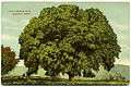 Purportedly "famous" Elm, ca. 1910
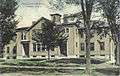 High School, 1910
References
- ↑ Early Historical Highlights of the Town of Canaan (Commonly Known As Falls Village) Archived April 5, 2009, at the Wayback Machine., Town of Canaan website
- ↑ "Pane-Joyce Genealogy". Clark University. Retrieved 2010-05-30.
- ↑ "Annual Estimates of the Resident Population for Incorporated Places: April 1, 2010 to July 1, 2014". Retrieved June 4, 2015.
- ↑ "Census of Population and Housing". Census.gov. Archived from the original on May 11, 2015. Retrieved June 4, 2015.
- ↑ "American FactFinder". United States Census Bureau. Archived from the original on 2013-09-11. Retrieved 2008-01-31.
- ↑ "Registration and Party Enrollment Statistics as of October 25, 2005" (PDF). Connecticut Secretary of State. Archived from the original (PDF) on 2006-09-23. Retrieved 2006-10-02.
- ↑ "Philo Belden". Find A Grave. Retrieved May 22, 2015.
- ↑ "Steve Blass". Society for American Baseball Research. Retrieved May 23, 2014.
- ↑ "Judson Philips, 85, Author, Dies". New York Times. March 9, 1989. Retrieved May 23, 2014.
- ↑ "Catherine Roraback". Connecticut Women's Hall of Fame. Retrieved May 23, 2014.
- ↑ Lewis Cass Aldrich, ed. (1891). HISTORY OF Franklin AND Grand Isle Counties VERMONT. Syracuse, N Y.: D. Mason & Co. pp. 225–226.
External links
| Wikimedia Commons has media related to Canaan, Connecticut. |
- Town government Web site
- Northwest Connecticut Arts Council
- Northwest Connecticut Convention and Visitors Bureau

Municipalities and communities of Litchfield County, Connecticut, United States | ||
|---|---|---|
| Consolidated city | 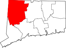 | |
| Towns | ||
| Non-consolidated city |
| |
| Boroughs | ||
| Other communities | ||