Couleuvre
| Couleuvre | |
|---|---|
|
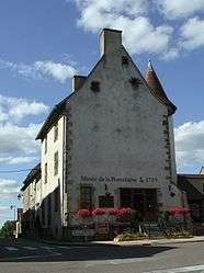
The museum in Couleuvre | |
 Couleuvre | |
|
Location within Auvergne-Rhône-Alpes region  Couleuvre | |
| Coordinates: 46°40′22″N 2°54′30″E / 46.6728°N 2.9083°ECoordinates: 46°40′22″N 2°54′30″E / 46.6728°N 2.9083°E | |
| Country | France |
| Region | Auvergne-Rhône-Alpes |
| Department | Allier |
| Arrondissement | Moulins |
| Canton | Bourbon-l'Archambault |
| Intercommunality | Pays de Tronçais |
| Government | |
| • Mayor (2014–2020) | Daniel Rondet |
| Area1 | 53.83 km2 (20.78 sq mi) |
| Population (2012)2 | 578 |
| • Density | 11/km2 (28/sq mi) |
| Time zone | CET (UTC+1) |
| • Summer (DST) | CEST (UTC+2) |
| INSEE/Postal code | 03087 / 03320 |
| Elevation |
207–317 m (679–1,040 ft) (avg. 236 m or 774 ft) |
|
1 French Land Register data, which excludes lakes, ponds, glaciers > 1 km² (0.386 sq mi or 247 acres) and river estuaries. 2 Population without double counting: residents of multiple communes (e.g., students and military personnel) only counted once. | |
Couleuvre is a commune in the department of Allier in Auvergne in central France.
Population
| Historical population | ||
|---|---|---|
| Year | Pop. | ±% |
| 1962 | 1,056 | — |
| 1968 | 1,126 | +6.6% |
| 1975 | 900 | −20.1% |
| 1982 | 796 | −11.6% |
| 1990 | 716 | −10.1% |
| 1999 | 645 | −9.9% |
| 2008 | 582 | −9.8% |
| 2012 | 578 | −0.7% |
See also
References
External links
| Wikimedia Commons has media related to Couleuvre. |
This article is issued from Wikipedia - version of the 7/19/2015. The text is available under the Creative Commons Attribution/Share Alike but additional terms may apply for the media files.