Lusigny
| Lusigny | |
|---|---|
|
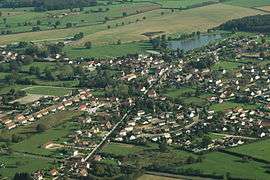
An aerial view of Lusigny | |
 Lusigny | |
|
Location within Auvergne-Rhône-Alpes region  Lusigny | |
| Coordinates: 46°35′19″N 3°29′32″E / 46.5886°N 3.4922°ECoordinates: 46°35′19″N 3°29′32″E / 46.5886°N 3.4922°E | |
| Country | France |
| Region | Auvergne-Rhône-Alpes |
| Department | Allier |
| Arrondissement | Moulins |
| Canton | Dompierre-sur-Besbre |
| Intercommunality | Pays de Chevagnes en Sologne Bourbonnaise |
| Government | |
| • Mayor (2014–2020) | André Jardin[1] |
| Area1 | 44.55 km2 (17.20 sq mi) |
| Population (2012)2 | 1,712 |
| • Density | 38/km2 (100/sq mi) |
| Time zone | CET (UTC+1) |
| • Summer (DST) | CEST (UTC+2) |
| INSEE/Postal code | 03156 / 03230 |
| Elevation |
224–273 m (735–896 ft) (avg. 251 m or 823 ft) |
|
1 French Land Register data, which excludes lakes, ponds, glaciers > 1 km² (0.386 sq mi or 247 acres) and river estuaries. 2 Population without double counting: residents of multiple communes (e.g., students and military personnel) only counted once. | |
Lusigny is a commune in the Allier department in central France.
Geography
Lusigny is a town located in the Auvergne region, in the department of Allier. Lusigny is located in the canton of Dompierre-sur-Besbre. It is located 12 kilometres (7.5 mi) from the town of Moulins. Its inhabitants are known as the Lusignoises in French.
Population
| Historical population | ||
|---|---|---|
| Year | Pop. | ±% |
| 1962 | 1,058 | — |
| 1968 | 1,066 | +0.8% |
| 1975 | 1,295 | +21.5% |
| 1982 | 1,541 | +19.0% |
| 1990 | 1,575 | +2.2% |
| 1999 | 1,428 | −9.3% |
| 2008 | 1,581 | +10.7% |
| 2012 | 1,712 | +8.3% |
See also
References
- ↑ "Liste nominative des communes de l'Allier (avec maire, arrondissement et canton)" [Nominative list of communes of Allier (with mayor, arrondissement and canton)] (PDF). Association of Mayors and Presidents of Communities of Allier (in French). 1 April 2015. Retrieved 4 September 2015.
| Wikimedia Commons has media related to Lusigny. |
This article is issued from Wikipedia - version of the 9/4/2015. The text is available under the Creative Commons Attribution/Share Alike but additional terms may apply for the media files.