Bagneux, Allier
| Bagneux | ||
|---|---|---|
|
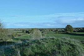
Site of the Belleperche Fort | ||
| ||
 Bagneux | ||
|
Location within Auvergne-Rhône-Alpes region  Bagneux | ||
| Coordinates: 46°39′30″N 3°12′23″E / 46.6583°N 3.2064°ECoordinates: 46°39′30″N 3°12′23″E / 46.6583°N 3.2064°E | ||
| Country | France | |
| Region | Auvergne-Rhône-Alpes | |
| Department | Allier | |
| Arrondissement | Moulins | |
| Canton | Moulins-1 | |
| Intercommunality | Moulins | |
| Government | ||
| • Mayor (2014–2020) | Yves Veniat | |
| Area1 | 24.87 km2 (9.60 sq mi) | |
| Population (2013)2 | 320 | |
| • Density | 13/km2 (33/sq mi) | |
| Time zone | CET (UTC+1) | |
| • Summer (DST) | CEST (UTC+2) | |
| INSEE/Postal code | 03015 / 03460 | |
| Elevation |
192–262 m (630–860 ft) (avg. 212 m or 696 ft) | |
|
1 French Land Register data, which excludes lakes, ponds, glaciers > 1 km² (0.386 sq mi or 247 acres) and river estuaries. 2 Population without double counting: residents of multiple communes (e.g., students and military personnel) only counted once. | ||
Bagneux is a French commune of the Allier department in the Auvergne-Rhône-Alpes region of central France.
The inhabitants of the commune are known as Bagnolais or Bagnolaises.[1]
Geography
Bagneux is located some 30 km (19 mi) south-east of Sancoins and 15 km (9.3 mi) north-west of Moulins. Access to the commune is by the D287 from Couzon in the west which goes to the village. The D101 comes from Aubigny in the north-west and passes through the commune and the village continuing south-east to Montilly. The D13 from Couzon to Montilly passes through the south-west of the commune. The D133 comes from Aurouër in the east and passes through the village before continuing south-west to Agonges. There are several hamlets in the commune: Les Amiel, Saligny, and Ray. There are large forests in the west of the commune with the eastern half mostly farmland.[2]
The Allier river flows north-west along the eastern border of the commune although it does not correspond exactly to the border and small portions of the commune are on the right bank. Many streams rise in the commune and flow eastwards to join the Allier. There are also several small lakes in the commune, both natural and artificial, which feed the streams.[2]
Neighbouring communes and villages[3]
 |
Aubigny | Tresnay | | |
| Couzon | |
Villeneuve-sur-Allier | ||
| ||||
| | ||||
| Agonges | Montilly | Trévol |
History
The Chateau of Belleperche, located on the territory of the commune, was besieged in 1370 during the Hundred Years War. Free companies of Gascon mercenaries and marauders working for the English seized it in 1369 and retained as prisoner the Dowager Duchess of Bourbon, Isabella de Valois. The castle was besieged by the troops of the Dukes of Bourbon and Burgundy. The "Free companies" were expelled, but they took the duchess with them as hostage.
Heraldry
.svg.png) |
Blazon: Argent, a band wavy of Azure between in chief a sword of Or with hilt of sable posed in bend, in base an oak leaf Vert also in bend; all cantoned in Gules charged with a tower of Or, port open, masoned and windowed in Sable. |
Administration
| From | To | Name | Party | Position |
|---|---|---|---|---|
| 1838 | 1842 | Jean François Alexandre Théodore Patissier | ||
| 1898 | 1908 | Jean Baptiste Emile Firmin Boutry | ||
| 2001 | 2020 | Yves Veniat[5] | DVG |
(Not all data is known)
Demography
In 2013 the commune had 320 inhabitants.[6] The evolution of the number of inhabitants is known from the population censuses conducted in the commune since 1793. From the 21st century, a census of communes with fewer than 10,000 inhabitants is held every five years, unlike larger communes that have a sample survey every year.[Note 1]
| 1793 | 1800 | 1806 | 1821 | 1831 | 1836 | 1841 | 1846 | 1851 |
|---|---|---|---|---|---|---|---|---|
| 425 | 360 | 420 | 483 | 429 | 424 | 403 | 396 | 389 |
| 1856 | 1861 | 1866 | 1872 | 1876 | 1881 | 1886 | 1891 | 1896 |
|---|---|---|---|---|---|---|---|---|
| 404 | 379 | 369 | 401 | 425 | 482 | 429 | 493 | 468 |
| 1901 | 1906 | 1911 | 1921 | 1926 | 1931 | 1936 | 1946 | 1954 |
|---|---|---|---|---|---|---|---|---|
| 459 | 455 | 460 | 389 | 388 | 364 | 313 | 324 | 308 |
| 1962 | 1968 | 1975 | 1982 | 1990 | 1999 | 2006 | 2010 | 2013 |
|---|---|---|---|---|---|---|---|---|
| 328 | 293 | 240 | 234 | 276 | 280 | 264 | 311 | 320 |
Sources : Ldh/EHESS/Cassini until 1962, INSEE database from 1968 (population without double counting and municipal population from 2006)

Sites and monuments
- The Romanesque Church of Saint Paul (12th century)
 is registered as an historical monument.[7] The Church contains three items that are registered as historical objects:
- The Motte of the vanished fortified castle of Belleperche. This mound is at an altitude of 2,138 m south-east of the Church
Notable people linked to the commune
- Isabella de Valois, Dowager Duchess of Bourbon, mother of Duke Louis II of Bourbon, held prisoner in Belleperche from 1369 to 1370.
See also
External links
- Bagneux on the old National Geographic Institute website (French)
- Bagneux on Lion1906
- Bagneux on Google Maps
- Bagneux on Géoportail, National Geographic Institute (IGN) website (French)
- Bagneux on the 1750 Cassini Map
- Bagneux on the INSEE website (French)
- INSEE (French)
Notes and references
Notes
- ↑ At the beginning of the 21st century, the methods of identification have been modified by Law No. 2002-276 of 27 February 2002, the so-called "law of local democracy" and in particular Title V "census operations" allows, after a transitional period running from 2004 to 2008, the annual publication of the legal population of the different French administrative districts. For communes with a population greater than 10,000 inhabitants, a sample survey is conducted annually, the entire territory of these communes is taken into account at the end of the period of five years. The first "legal population" after 1999 under this new law came into force on 1 January 2009 and was based on the census of 2006.
References
- ↑ Inhabitants of Allier (French)
- 1 2 Google Maps
- ↑ Géoportail, IGN (French)
- ↑ List of Mayors of France (French)
- ↑ Re-elected in 2014: "Liste nominative des communes de l'Allier (avec maire, arrondissement et canton)" [Nominative list of communes of Allier (with mayor, arrondissement and canton)] (PDF). Association of Mayors and Presidents of Communities of Allier. 1 April 2015. Archived from the original (PDF) on 18 May 2015. Retrieved 13 May 2015.
- ↑ "Legal populations - Bagneux". INSEE (in French). Retrieved 24 January 2016.
- ↑ Ministry of Culture, Mérimée PA00092981 Church of Saint Paul (French)

- ↑ Ministry of Culture, Palissy PM03000023 Commemorative Plaque (French)
- ↑ Ministry of Culture, Palissy PM03000022 Bronze Bell (French)
- ↑ Ministry of Culture, Palissy PM03000021 Processional Cross
(French)
| Wikimedia Commons has media related to Bagneux, Allier. |