Désertines, Allier
| Désertines | |
|---|---|
|
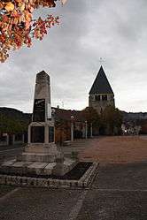
The church in Désertines | |
 Désertines | |
|
Location within Auvergne-Rhône-Alpes region  Désertines | |
| Coordinates: 46°21′N 2°37′E / 46.35°N 2.62°ECoordinates: 46°21′N 2°37′E / 46.35°N 2.62°E | |
| Country | France |
| Region | Auvergne-Rhône-Alpes |
| Department | Allier |
| Arrondissement | Montluçon |
| Canton | Montluçon-2 |
| Intercommunality | Montluçon |
| Government | |
| • Mayor (2014–2020) | Christian Sanvoisin |
| Area1 | 8.34 km2 (3.22 sq mi) |
| Population (2012)2 | 4,232 |
| • Density | 510/km2 (1,300/sq mi) |
| Time zone | CET (UTC+1) |
| • Summer (DST) | CEST (UTC+2) |
| INSEE/Postal code | 03098 / 03630 |
| Elevation |
193–384 m (633–1,260 ft) (avg. 216 m or 709 ft) |
|
1 French Land Register data, which excludes lakes, ponds, glaciers > 1 km² (0.386 sq mi or 247 acres) and river estuaries. 2 Population without double counting: residents of multiple communes (e.g., students and military personnel) only counted once. | |
Désertines is a commune in the Allier department in central France.
Population
| Historical population | ||
|---|---|---|
| Year | Pop. | ±% |
| 1793 | 1,000 | — |
| 1800 | 1,022 | +2.2% |
| 1806 | 1,035 | +1.3% |
| 1821 | 1,145 | +10.6% |
| 1831 | 1,137 | −0.7% |
| 1836 | 1,196 | +5.2% |
| 1841 | 1,161 | −2.9% |
| 1846 | 1,351 | +16.4% |
| 1851 | 1,413 | +4.6% |
| 1856 | 1,649 | +16.7% |
| 1861 | 1,591 | −3.5% |
| 1866 | 1,777 | +11.7% |
| 1872 | 1,967 | +10.7% |
| 1876 | 2,020 | +2.7% |
| 1881 | 2,350 | +16.3% |
| 1886 | 2,320 | −1.3% |
| 1891 | 2,350 | +1.3% |
| 1896 | 2,592 | +10.3% |
| 1901 | 3,000 | +15.7% |
| 1906 | 3,080 | +2.7% |
| 1911 | 2,960 | −3.9% |
| 1921 | 2,923 | −1.2% |
| 1926 | 2,892 | −1.1% |
| 1931 | 3,217 | +11.2% |
| 1936 | 3,236 | +0.6% |
| 1946 | 3,729 | +15.2% |
| 1954 | 3,997 | +7.2% |
| 1962 | 4,331 | +8.4% |
| 1968 | 4,697 | +8.5% |
| 1975 | 4,593 | −2.2% |
| 1982 | 4,912 | +6.9% |
| 1990 | 4,961 | +1.0% |
| 1999 | 4,646 | −6.3% |
| 2008 | 4,441 | −4.4% |
| 2012 | 4,232 | −4.7% |
See also
References
| Wikimedia Commons has media related to Désertines. |
This article is issued from Wikipedia - version of the 8/1/2015. The text is available under the Creative Commons Attribution/Share Alike but additional terms may apply for the media files.