Dunfee, Indiana
| Dunfee | |
|---|---|
| Unincorporated community | |
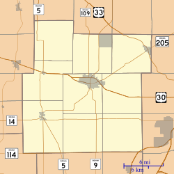 Dunfee Dunfee as seen in a map of Whitley County | |
| Coordinates: 41°05′08″N 85°20′13″W / 41.08556°N 85.33694°WCoordinates: 41°05′08″N 85°20′13″W / 41.08556°N 85.33694°W | |
| Country | United States |
| State | Indiana |
| County | Whitley, Allen |
| Township | Jefferson, Aboite |
| Elevation[1] | 856 ft (261 m) |
| ZIP code | 46725 |
| GNIS feature ID | 433778 |
Dunfee is an unincorporated community in Whitley and Allen counties, in the U.S. state of Indiana.[2]
History
A post office was established at Dunfee in 1883, and remained in operation until it was discontinued in 1917.[3]
Geography
Dunfee is located at 41°05′08″N 85°20′13″W / 41.08556°N 85.33694°W.
References
- ↑ "US Board on Geographic Names". United States Geological Survey. 2007-10-25. Retrieved 2016-06-17.
- ↑ "Dunfee, Indiana". Geographic Names Information System. United States Geological Survey. Retrieved 2016-07-05.
- ↑ "Whitley County". Jim Forte Postal History. Retrieved 5 July 2016.
Municipalities and communities of Whitley County, Indiana, United States | ||
|---|---|---|
| City | ||
| Towns | ||
| Townships | ||
| CDP | ||
| Other unincorporated communities | ||
| Footnotes | ‡This populated place also has portions in an adjacent county or counties | |
Municipalities and communities of Allen County, Indiana, United States | ||
|---|---|---|
| Cities | ||
| Towns | ||
| Townships | ||
| CDPs | ||
| Other unincorporated communities |
| |
| Footnotes | ‡This populated place also has portions in an adjacent county or counties | |
This article is issued from Wikipedia - version of the 7/11/2016. The text is available under the Creative Commons Attribution/Share Alike but additional terms may apply for the media files.