Harlan, Indiana
| Harlan, Indiana | |
|---|---|
| Census-designated place | |
 Harlan | |
| Coordinates: 41°11′46″N 84°55′11″W / 41.19611°N 84.91972°WCoordinates: 41°11′46″N 84°55′11″W / 41.19611°N 84.91972°W | |
| Country | United States |
| State | Indiana |
| County | Allen |
| Township | Springfield |
| Area | |
| • Total | 3.1 sq mi (8.0 km2) |
| • Land | 3.1 sq mi (8.0 km2) |
| • Water | 0 sq mi (0 km2) |
| Elevation[1] | 784 ft (239 m) |
| Population (2010) | |
| • Total | 1,634 |
| • Density | 526/sq mi (203.2/km2) |
| ZIP code | 46743 |
Harlan is an unincorporated census-designated place (CDP) in Springfield Township, Allen County, Indiana, United States. As of the 2010 census, Harlan had a population of 1,634.[2] Present-day Harlan originally consisted of two communities, Harlan and Maysville. The border between the two towns was Georgetown Road (Indiana State Road 37), with Harlan being on the north side of the road.[3]
Maysville faded from existence when the post office was built in Harlan sometime around the turn of the 20th century.
Geography
Harlan is located at 41°11′46″N 84°55′11″W / 41.19611°N 84.91972°W. It is located on State Road 37, approximately 15 miles (24 km) northeast of Fort Wayne and 7 miles (11 km) west of the Ohio state line.
References
- ↑ "USGS detail on Harlan". Retrieved 2007-11-05.
- ↑ "Geographic Identifiers: 2010 Demographic Profile Data (G001): Harlan CDP, Indiana". U.S. Census Bureau, American Factfinder. Retrieved March 26, 2013.
- ↑ Andreas, Alfred Theodore (1876). "Allen County". Illustrated Historical Atlas of the State of Indiana. Chicago: Baskin, Forster & Company.
External links
Municipalities and communities of Allen County, Indiana, United States | ||
|---|---|---|
| Cities | ||
| Towns | ||
| Townships | ||
| CDPs | ||
| Other unincorporated communities |
| |
| Footnotes | ‡This populated place also has portions in an adjacent county or counties | |
| Counties | 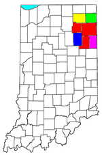 | |
|---|---|---|
| Municipalities with population over 10,000 in 2010 | ||
| Municipalities with population 1,000-10,000 in 2010 | ||
| Municipalities with population under 1,000 in 2010 | ||
| CDPs | ||
This article is issued from Wikipedia - version of the 9/3/2016. The text is available under the Creative Commons Attribution/Share Alike but additional terms may apply for the media files.