Zanesville, Indiana
| Zanesville, Indiana | |
|---|---|
| Town | |
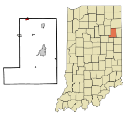 Location of Zanesville in the state of Indiana | |
| Coordinates: 40°54′57″N 85°16′53″W / 40.91583°N 85.28139°WCoordinates: 40°54′57″N 85°16′53″W / 40.91583°N 85.28139°W | |
| Country | United States |
| State | Indiana |
| Counties | Wells, Allen |
| Township | Union, Lafayette |
| Area[1] | |
| • Total | 0.83 sq mi (2.15 km2) |
| • Land | 0.82 sq mi (2.12 km2) |
| • Water | 0.01 sq mi (0.03 km2) |
| Elevation[2] | 810 ft (247 m) |
| Population (2010)[3] | |
| • Total | 600 |
| • Estimate (2012[4]) | 605 |
| • Density | 731.7/sq mi (282.5/km2) |
| Time zone | Eastern (EST) (UTC-5) |
| • Summer (DST) | EDT (UTC-4) |
| ZIP code | 46799 |
| Area code(s) | 260 |
| FIPS code | 18-86318[5] |
| GNIS feature ID | 446424 |
Zanesville is a town in Allen and Wells counties in the U.S. state of Indiana, southwest of Fort Wayne.[6] The population was 600 at the 2010 census.
History
Zanesville was likely named after Zanesville, Ohio.[7]
A post office was established at Zanesville in 1854, and remained in operation until it was discontinued in 1964.[8]
Geography
Zanesville is located at 40°54′57″N 85°16′53″W / 40.91583°N 85.28139°W (40.915947, -85.281260).[9]
According to the 2010 census, Zanesville has a total area of 0.83 square miles (2.15 km2), of which 0.82 square miles (2.12 km2) (or 98.8%) is land and 0.01 square miles (0.03 km2) (or 1.2%) is water.[1]
Demographics
| Historical population | |||
|---|---|---|---|
| Census | Pop. | %± | |
| 1880 | 93 | — | |
| 2000 | 602 | — | |
| 2010 | 600 | −0.3% | |
| Est. 2015 | 610 | [10] | 1.7% |
2010 census
As of the census[3] of 2010, there were 600 people, 229 households, and 175 families residing in the town. The population density was 731.7 inhabitants per square mile (282.5/km2). There were 239 housing units at an average density of 291.5 per square mile (112.5/km2). The racial makeup of the town was 98.5% White, 0.2% African American, 0.2% Native American, 0.2% from other races, and 1.0% from two or more races. Hispanic or Latino of any race were 1.5% of the population.
There were 229 households of which 38.0% had children under the age of 18 living with them, 62.4% were married couples living together, 9.2% had a female householder with no husband present, 4.8% had a male householder with no wife present, and 23.6% were non-families. 18.8% of all households were made up of individuals and 8.7% had someone living alone who was 65 years of age or older. The average household size was 2.62 and the average family size was 3.01.
The median age in the town was 38.3 years. 27.2% of residents were under the age of 18; 6.5% were between the ages of 18 and 24; 25.3% were from 25 to 44; 28.1% were from 45 to 64; and 12.8% were 65 years of age or older. The gender makeup of the town was 49.7% male and 50.3% female.
2000 census
As of the census[5] of 2000, there were 602 people, 212 households, and 172 families residing in the town. The population density was 806.6 people per square mile (309.9/km²). There were 232 housing units at an average density of 310.8 per square mile (119.4/km²). The racial makeup of the town was 99.17% White, 0.17% Native American, 0.17% from other races, and 0.50% from two or more races. Hispanic or Latino of any race were 0.17% of the population.
There were 212 households out of which 40.1% had children under the age of 18 living with them, 70.3% were married couples living together, 9.0% had a female householder with no husband present, and 18.4% were non-families. 15.1% of all households were made up of individuals and 3.3% had someone living alone who was 65 years of age or older. The average household size was 2.84 and the average family size was 3.13.
In the town the population was spread out with 29.2% under the age of 18, 8.0% from 18 to 24, 29.9% from 25 to 44, 23.8% from 45 to 64, and 9.1% who were 65 years of age or older. The median age was 35 years. For every 100 females there were 96.1 males. For every 100 females age 18 and over, there were 97.2 males.
The median income for a household in the town was $57,727, and the median income for a family was $58,375. Males had a median income of $40,893 versus $22,500 for females. The per capita income for the town was $20,606. About 4.6% of families and 4.9% of the population were below the poverty line, including 6.1% of those under age 18 and 10.0% of those age 65 or over.
References
- 1 2 "G001 - Geographic Identifiers - 2010 Census Summary File 1". United States Census Bureau. Retrieved 2015-07-25.
- ↑ "US Board on Geographic Names". United States Geological Survey. October 25, 2007. Retrieved 2016-07-06.
- 1 2 "American FactFinder". United States Census Bureau. Retrieved 2012-12-11.
- ↑ "Population Estimates". United States Census Bureau. Archived from the original on June 17, 2013. Retrieved 2013-06-25.
- 1 2 "American FactFinder". United States Census Bureau. Archived from the original on September 11, 2013. Retrieved 2008-01-31.
- ↑ "Zanesville, Indiana". Geographic Names Information System. United States Geological Survey. Retrieved 2016-07-06.
- ↑ "Profile for Zanesville, IN". ePodunk. Retrieved July 6, 2016.
- ↑ "Wells County". Jim Forte Postal History. Retrieved July 6, 2016.
- ↑ "US Gazetteer files: 2010, 2000, and 1990". United States Census Bureau. 2011-02-12. Retrieved 2011-04-23.
- ↑ "Annual Estimates of the Resident Population for Incorporated Places: April 1, 2010 to July 1, 2015". Retrieved July 2, 2016.
- ↑ "Census of Population and Housing". Census.gov. Archived from the original on May 11, 2015. Retrieved June 4, 2015.
Municipalities and communities of Allen County, Indiana, United States | ||
|---|---|---|
| Cities | ||
| Towns | ||
| Townships | ||
| CDPs | ||
| Other unincorporated communities |
| |
| Footnotes | ‡This populated place also has portions in an adjacent county or counties | |
Municipalities and communities of Wells County, Indiana, United States | ||
|---|---|---|
| City | ||
| Towns | ||
| Townships | ||
| Unincorporated communities | ||
| Footnotes | ‡This populated place also has portions in an adjacent county or counties | |
| Counties |  | |
|---|---|---|
| Municipalities with population over 10,000 in 2010 | ||
| Municipalities with population 1,000-10,000 in 2010 | ||
| Municipalities with population under 1,000 in 2010 | ||
| CDPs | ||