Le Mas-d'Azil
| Le Mas-d'Azil | ||
|---|---|---|
|
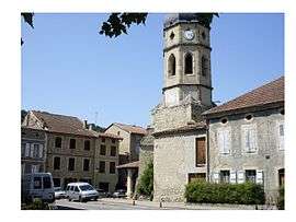
The church of Saint-Etienne | ||
| ||
 Le Mas-d'Azil | ||
|
Location within Occitanie region  Le Mas-d'Azil | ||
| Coordinates: 43°04′54″N 1°21′41″E / 43.0817°N 1.3614°ECoordinates: 43°04′54″N 1°21′41″E / 43.0817°N 1.3614°E | ||
| Country | France | |
| Region | Occitanie | |
| Department | Ariège | |
| Arrondissement | Pamiers | |
| Canton | Le Mas-d'Azil | |
| Intercommunality | L'Arize | |
| Government | ||
| • Mayor (2008–2014) | Raymond Berdou | |
| Area1 | 39.36 km2 (15.20 sq mi) | |
| Population (2008)2 | 1,226 | |
| • Density | 31/km2 (81/sq mi) | |
| Time zone | CET (UTC+1) | |
| • Summer (DST) | CEST (UTC+2) | |
| INSEE/Postal code | 09181 / 09290 | |
| Elevation |
275–580 m (902–1,903 ft) (avg. 320 m or 1,050 ft) | |
|
1 French Land Register data, which excludes lakes, ponds, glaciers > 1 km² (0.386 sq mi or 247 acres) and river estuaries. 2 Population without double counting: residents of multiple communes (e.g., students and military personnel) only counted once. | ||
.svg.png)
Le Mas-d'Azil is a commune in the Ariège department in southwestern France, containing a cave that is the typesite for the prehistoric Azilian culture. The Grotte du Mas d'Azil (sometimes hyphenated, sometimes not) is a "supersite" with rich remains of human usage from about 30,000 years ago, and is also a key site for the preceding Magdalenian culture. The D119 road runs right through the large cave, which is a natural tunnel 420 metres long and 50 metres high.[1]
Population
| Historical population | ||
|---|---|---|
| Year | Pop. | ±% |
| 1962 | 1,643 | — |
| 1968 | 1,682 | +2.4% |
| 1975 | 1,568 | −6.8% |
| 1982 | 1,404 | −10.5% |
| 1990 | 1,307 | −6.9% |
| 1999 | 1,117 | −14.5% |
| 2008 | 1,226 | +9.8% |
See also
References
- ↑ Philippe Barbour; Dana Facaros; Michael Pauls (2004). Cadogan guides France. New Holland Publishers. p. 520. ISBN 186011881X.; Paul G. Bahn; Jean Vertut (1997). Journey Through the Ice Age. p. 96. ISBN 9780520213067.
| Wikimedia Commons has media related to Le Mas-d'Azil. |
This article is issued from Wikipedia - version of the 9/24/2016. The text is available under the Creative Commons Attribution/Share Alike but additional terms may apply for the media files.