Montpezat-de-Quercy
| Montpezat-de-Quercy | ||
|---|---|---|
|
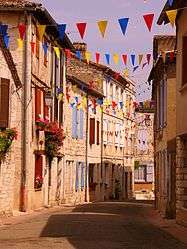
The street behind the town gate, in Montpezat-de-Quercy | ||
| ||
 Montpezat-de-Quercy | ||
|
Location within Occitanie region  Montpezat-de-Quercy | ||
| Coordinates: 44°14′21″N 1°28′38″E / 44.2392°N 1.4772°ECoordinates: 44°14′21″N 1°28′38″E / 44.2392°N 1.4772°E | ||
| Country | France | |
| Region | Occitanie | |
| Department | Tarn-et-Garonne | |
| Arrondissement | Montauban | |
| Canton | Montpezat-de-Quercy | |
| Intercommunality | Quercy caussadais | |
| Government | ||
| • Mayor (2008-2014) | Raymond Massip | |
| Area1 | 44.02 km2 (17.00 sq mi) | |
| Population (2006)2 | 1,436 | |
| • Density | 33/km2 (84/sq mi) | |
| Time zone | CET (UTC+1) | |
| • Summer (DST) | CEST (UTC+2) | |
| INSEE/Postal code | 82131 / 82270 | |
| Elevation |
126–309 m (413–1,014 ft) (avg. 275 m or 902 ft) | |
|
1 French Land Register data, which excludes lakes, ponds, glaciers > 1 km² (0.386 sq mi or 247 acres) and river estuaries. 2 Population without double counting: residents of multiple communes (e.g., students and military personnel) only counted once. | ||
.svg.png)
Montpezat-de-Quercy is a commune in the Tarn-et-Garonne département in the Occitanie région in southern France.
Montpezat-de-Quercy is situated 35 km (22 mi) north of Montauban. The commune has been listed as a protected town, mainly thanks to its 14th-century church, which contains tapestries from the sixteenth century relating the life of St Martin.
Demographics
| 1962 | 1968 | 1975 | 1982 | 1990 | 1999 | 2006 |
|---|---|---|---|---|---|---|
| 1377 | 1448 | 1419 | 1407 | 1411 | 1378 | 1436 |
| Starting in 1962: Populations without duplicates | ||||||
See also
References
External links
| Wikimedia Commons has media related to Montpezat-de-Quercy. |
- Site of Montpezat-de-Quercy
- Montpezat-de-Quercy from the Quid site
- The closest communes to Montpezat-de-Quercy
- Montpezat-de-Quercy on a map of France
- Montpezat-de-Quercy on Mapquest
This article is issued from Wikipedia - version of the 11/12/2016. The text is available under the Creative Commons Attribution/Share Alike but additional terms may apply for the media files.