Monbéqui
| Monbéqui | ||
|---|---|---|
 | ||
| ||
 Monbéqui | ||
|
Location within Occitanie region  Monbéqui | ||
| Coordinates: 43°53′37″N 1°14′26″E / 43.8936°N 1.2406°ECoordinates: 43°53′37″N 1°14′26″E / 43.8936°N 1.2406°E | ||
| Country | France | |
| Region | Occitanie | |
| Department | Tarn-et-Garonne | |
| Arrondissement | Montauban | |
| Canton | Grisolles | |
| Intercommunality | Garonne et Canal | |
| Government | ||
| • Mayor (2014–2020) | Alfred Marty | |
| Area1 | 6.78 km2 (2.62 sq mi) | |
| Population (2010)2 | 587 | |
| • Density | 87/km2 (220/sq mi) | |
| Time zone | CET (UTC+1) | |
| • Summer (DST) | CEST (UTC+2) | |
| INSEE/Postal code | 82114 / 82170 | |
| Elevation |
88–104 m (289–341 ft) (avg. 97 m or 318 ft) | |
|
1 French Land Register data, which excludes lakes, ponds, glaciers > 1 km² (0.386 sq mi or 247 acres) and river estuaries. 2 Population without double counting: residents of multiple communes (e.g., students and military personnel) only counted once. | ||
.svg.png)
Monbéqui is a commune in the Tarn-et-Garonne department in the Occitanie region in southern France.
Monuments
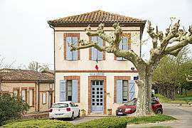
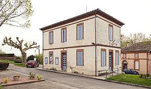 Town hall
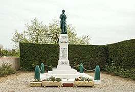 War monument
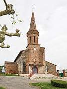 the church
See also
References
| Wikimedia Commons has media related to Monbéqui. |
This article is issued from Wikipedia - version of the 11/12/2016. The text is available under the Creative Commons Attribution/Share Alike but additional terms may apply for the media files.