Montjoi, Tarn-et-Garonne
| Montjoi | |
|---|---|
|
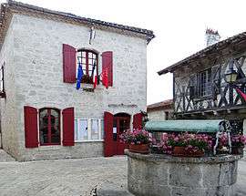
The town hall of Montjoi | |
 Montjoi | |
|
Location within Occitanie region  Montjoi | |
| Coordinates: 44°11′51″N 0°55′15″E / 44.1975°N 0.9208°ECoordinates: 44°11′51″N 0°55′15″E / 44.1975°N 0.9208°E | |
| Country | France |
| Region | Occitanie |
| Department | Tarn-et-Garonne |
| Arrondissement | Castelsarrasin |
| Canton | Valence |
| Intercommunality | Deux Rives |
| Government | |
| • Mayor (2001–2008) | Renée Raffy |
| Area1 | 14.67 km2 (5.66 sq mi) |
| Population (2006)2 | 183 |
| • Density | 12/km2 (32/sq mi) |
| Time zone | CET (UTC+1) |
| • Summer (DST) | CEST (UTC+2) |
| INSEE/Postal code | 82130 / 82400 |
| Elevation |
80–217 m (262–712 ft) (avg. 165 m or 541 ft) |
|
1 French Land Register data, which excludes lakes, ponds, glaciers > 1 km² (0.386 sq mi or 247 acres) and river estuaries. 2 Population without double counting: residents of multiple communes (e.g., students and military personnel) only counted once. | |
Montjoi is a commune in the Tarn-et-Garonne department in the Occitanie region in southern France. Perched on a limestone cliff, the village is an ancient fortified citadel of the 13th century, extensively restored, giving views of the valley of the Séoune.
Geography
The Séoune forms part of the commune's south-eastern border, then flows westward through the southern part of the commune.
See also
External links
http://www.toulousevisit.com/descriptif/region/82/montjoi/montjoi.htm
References
| Wikimedia Commons has media related to Montjoi (Tarn-et-Garonne). |
This article is issued from Wikipedia - version of the 11/12/2016. The text is available under the Creative Commons Attribution/Share Alike but additional terms may apply for the media files.