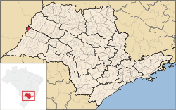
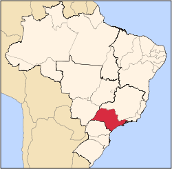
Pauliceia
Pauliceia is a municipality located in interior of the state of São Paulo, Brazil. The population is 6,981 (2015 est.) in an area of 374.1 km².[1] The elevation is 328 m.
History
The settlement Pauliceia was founded by Ezequiel Joaquim de Oliveira on June 29, 1947.
The property was opened in order to locate a city on the banks of the Parana River, for future exchanges with the neighboring state of Mato Grosso (current state of Mato Grosso do Sul).
With the advent of the promulgation of the new Constitutional Charter of the State of São Paulo, which released the creation of new municipalities, especially on the border with other states, the population of the village Pauliceia managed to raise the county, supported by the Organic Law of Municipalities.
Pauliceia was elevated to district and municipality, of lands separated from Gracianópolis (current Tupi Paulista), by Law No. 233 of December 24, 1948. As council was formed with the districts of peace Pauliceia, Panorama and Santa Mercedes. By Law No. 2456 of December 30, 1953, were dismembered Pauliceia of Panorama and the districts of Santa Mercedes. Although the Law No. 233 of December 24, 1948, the municipality was Pauliceia belonging to the county of Lucélia. Was incorporated into the district of Dracena, by Law No. 2456 of December 30, 1953, implemented on 1 January 1954.
Geography
The municipality contains part of the 8,885 hectares (21,960 acres) Mouth of the Aguapeí Private Natural Heritage Reserve, created in 2010.[2]
On the shores of Paraná River, it has beautiful scenery and fishing spots. In addition to the Aguapeí River.
Demographics
Census Data - 2000
- Total population: 5,302
- Urban: 3,934
- Rural: 1368
- Men: 2,755
- Women: 2,547
- Population density (inhabitants / km ²): 14.14
- Infant mortality 1 year (per thousand): 17.89
- Life expectancy (year): 70.18
- Fertility rate (children per woman): 3.10
- Literacy Rate: 85.52
- Human Development Index: 0.754
- Income: 0.670
- Longevity: 0.753
- Education: 0.838
References
External links
|
|---|
|
|
|
|
|
| |
|---|
| Capital | |
|---|
| 1,000,000+ | |
|---|
| 500,000+ | |
|---|
| 200,000+ | |
|---|
| 100,000+ | |
|---|
|
|
|
| |
|---|
| Presidente Prudente |
|---|
| Adamantina | |
|---|
| Dracena | |
|---|
| Presidente Prudente | |
|---|
|
|
|
|
|
|---|
|
|
|
| Araçatuba |
|---|
| Andradina | |
|---|
| Araçatuba | |
|---|
| Birigui | |
|---|
|
| |
|
|
|
|
|
| Bauru |
|---|
| Avaré | |
|---|
| Bauru | |
|---|
| Botucatu | |
|---|
| Jaú | |
|---|
| Lins | |
|---|
|
|
|
| Campinas |
|---|
| Amparo | |
|---|
| Campinas | |
|---|
| Mogi Mirim | |
|---|
| Pirassununga | |
|---|
| São João da Boa Vista | |
|---|
|
|
|
| Itapetininga |
|---|
| Capão Bonito | |
|---|
| Itapetininga | |
|---|
| Itapeva | |
|---|
| Tatuí | |
|---|
|
|
|
|
|
| Macro Metropolitana Paulista |
|---|
| Bragança Paulista | |
|---|
| Jundiaí | |
|---|
| Piedade | |
|---|
| Sorocaba | |
|---|
|
|
|
|
|
| Metropolitana de São Paulo |
|---|
| Franco da Rocha | |
|---|
| Guarulhos | |
|---|
| Itapecerica da Serra | |
|---|
| Mogi das Cruzes | |
|---|
| Osasco | |
|---|
| Santos | |
|---|
| São Paulo | |
|---|
|
|
|
| Piracicaba |
|---|
| Limeira | |
|---|
| Piracicaba | |
|---|
| Rio Claro | |
|---|
|
|
|
| Presidente Prudente |
|---|
| Adamantina | |
|---|
| Dracena | |
|---|
| Presidente Prudente | |
|---|
|
|
|
| Ribeirão Preto |
|---|
| Barretos | |
|---|
| Batatais | |
|---|
| Franca | |
|---|
| Ituverava | |
|---|
| Jaboticabal | |
|---|
| Ribeirão Preto | |
|---|
| São Joaquim da Barra | |
|---|
|
|
|
| São José do Rio Preto |
|---|
| Auriflama | |
|---|
| Catanduva | |
|---|
| Fernandópolis | |
|---|
| Jales | |
|---|
| Nhandeara | |
|---|
| Novo Horizonte | |
|---|
| São José do Rio Preto | |
|---|
| Votuporanga | |
|---|
|
|
|
| Vale do Paraíba Paulista |
|---|
| Bananal | |
|---|
| Campos do Jordão | |
|---|
| Caraguatatuba | |
|---|
| Guaratinguetá | |
|---|
| Paraibuna/Paraitinga | |
|---|
| São José dos Campos | |
|---|
|
|