Assasuni Upazila
| Assasuni আশাশুনি | |
|---|---|
| Upazila | |
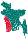
 Assasuni Location in Bangladesh | |
| Coordinates: 22°33′N 89°10.086′E / 22.550°N 89.168100°ECoordinates: 22°33′N 89°10.086′E / 22.550°N 89.168100°E | |
| Country |
|
| Division | Khulna Division |
| District | Satkhira District |
| Area | |
| • Total | 402.36 km2 (155.35 sq mi) |
| Population (1991) | |
| • Total | 220,957 |
| • Density | 549/km2 (1,420/sq mi) |
| Time zone | BST (UTC+6) |
| Website | Official Map of Assasuni |
Assasuni (Bengali: আশাশুনি, Aashashooni, means hearing the hope ) is an Upazila of Satkhira District in Khulna Division, Bangladesh.
Geography
Assasuni is located at 22°33′00″N 89°10′05″E / 22.5500°N 89.1681°E. It has 40,735 households and a total area of 402.36 km².
Marichchap, Kholpetua, Betna and Kopothakkho are rivers of Assasuni.
Demographics
According to the 2001 Bangladesh population census, Assasuni had a population of 249,244, consisting of 126,399 males and 122,845 females. The average population of each union, mouza and village was 22659, 1793 and 1030 respectively. The average literacy rate was 50% in 2011 and 40.30% in 2001.
Administration
Assasuni has 11 unions (Sriula, Assasuni, Kadakati, Kulla, Budhhata, Durgapur, Borodal, Khajra, Sovnali, Protapnagore, and Anulia), 143 mauzas and 242 villages.
Education
- Kalima Khali Azizia Siddikia senior Fazil Madrasha
- Kalima Khali Govt. Primary School
- Sriula High School
- Tuardanga H,F High school
- Harivanga High School
- Harivanga Govt.Primary School
- 68 No. Sriula Govt. Primary School
- Assasuni High School
- Dargahpur SKRH High School
- Assasuni College
- Budhhata B,B,M collegiate
- GUNAKARKATI SHAH MUHAMMAD YAHYA SECONDARY SCHOOL
- Assasuni Secondary Girl's High School
- Chapra High School
- Kunduria High School
- Mariala High School
- A.P.S Degree College
- Kadakati Arar High School
- Mohiskur Govt. Primary School
- Goaldanga Fakirbari High School
- Bichhat new model high school
- batra ebtedai madrasha ataur
- Bardal Secendary Girl's High School
Environmental issues
Assasuni is now under severe natural threat. Water logging is miserable during the rainy season. Cyclone Aila affected Assasuni badly in 2009. Crops failed tremendously. The earthen embankments and seawalls are always on the threat of erosion during every rainy seasons.
External links
- De, Sachhida Nanda (2012). "Assasuni Upazila". In Islam, Sirajul; Jamal, Ahmed A. Banglapedia: National Encyclopedia of Bangladesh (Second ed.). Asiatic Society of Bangladesh.
| Upazila/Thana: | ||
|---|---|---|