Kachua Upazila, Bagerhat
| Kachua কচুয়া | |
|---|---|
| Upazila | |
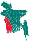
 Kachua Location in Bangladesh | |
| Coordinates: 22°39′N 89°53′E / 22.650°N 89.883°ECoordinates: 22°39′N 89°53′E / 22.650°N 89.883°E | |
| Country |
|
| Division | Khulna Division |
| District | Bagerhat District |
| Government | |
| • Editor: | Lutfor Rahman |
| Area | |
| • Total | 131.62 km2 (50.82 sq mi) |
| Population (2010) | |
| • Total | 97,011 |
| • Density | 740/km2 (1,900/sq mi) |
| Time zone | BST (UTC+6) |
| Postal Code | 9310 (Kachua) , 9311 (Sonarkola) |
Kachua (Bengali: কচুয়া) is the first Upazila of Bagerhat District[1] in the Division of Khulna, Bangladesh. Distance from the zilla sodor is 16 km.
Geography
Kachua is located at 22°39′00″N 89°53′00″E / 22.6500°N 89.8833°E . It has 18,553 households and a total area of 131.62 km².
Demographics
According to the 2011 Bangladesh census, Kachua had a population of 97011. Males constituted 49.251% (47,778) of the population, and females 50.749% (49,233). The population aged 18 or over was 33675(M), 33677(F). Kachua had an average literacy rate of 61.5% (7+ years), compared to the national average of 32.4%.[2]
76.39% of the population are Muslim, 23.58% are Hindu and 0.03% follow other religions.
Arts and culture
CALTURE: KACHUA public library, a theatre group, 20+ rural clubs and 34 women's organizations.
Points of interest
Moghia raj bari (royal maghiya house, kings lived here before). The raj bari is nearly damaged but still visite worthy . However, people came to visit here from different places.
There is a raj temple. This royal temple used to worship gods and kings before . Here, Kali, Shyama, and the newly- week worship were . The Hindhu people village still has people worship different gods dedabira.
Punno Sanan (borunir bath) is a great occasion of fair. Every year more than 50,000 people attand this religious fair.
Archaeological heritage Shibpur Shivabari (1300 AD).
Historical events during the War of Liberation (1971) the Razakars killed 42 innocent people at Shakharikathi Hat of Badhal Union.
Mark of the War of Liberation - mass grave 7, memorial 2.
Administration
Kachua has 7 Unions/Wards, 78 Mauzas/Mahallas, and 96 villages.
Kachua Upazila, with an area of 131.62 km2, is bordered by Chitalmari Upazila on the north, Nazirpur and Pirojpur Sadar Upazilas on the east, Bagerhat Sadar Upazila on the west and Morrelganj Upazila on the south. The main rivers are Baleshwar, Bhairab and Bishkhali.
Kachua (Town) consists of 3 mouzas. The area of the town is 8.32 km2. The town has a population of 9,394, comprising 50.85% male and 49.15% female. The population density is 1129 per km2. The literacy rate among the town people is 44.3%. The town has one dakbungalow.
Kachua Thana was turned into an upazila in 1983. It consists of 7 union parishads, 75 mouzas and 96 villages.
Education
Literacy rate and educational institutions Average literacy 42.5%; male 47.5%, female 37.3%. Educational institutions: college 2, high school 16, madrasa 8, government primary school 48, non-government primary school 42. Notable institutions: Goalmath Rashikpal High School (1916) and Baraikhali Government Primary School (1918).
References
- ↑ Partho Dev Shaha (2012), "Kachua Upazila (Bagerhat District)", in Sirajul Islam and Ahmed A. Jamal, Banglapedia: National Encyclopedia of Bangladesh (Second ed.), Asiatic Society of Bangladesh
- ↑ "Population Census Wing, BBS.". Archived from the original on 2005-03-27. Retrieved November 10, 2006.
| Upazila/Thana: | ||
|---|---|---|