Debhata Upazila
| Debhata দেবহাটা | |
|---|---|
| Upazila | |
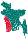
 Debhata Location in Bangladesh | |
| Coordinates: 22°34′N 88°58′E / 22.567°N 88.967°ECoordinates: 22°34′N 88°58′E / 22.567°N 88.967°E | |
| Country |
|
| Division | Khulna Division |
| District | Satkhira District |
| Area | |
| • Total | 176.33 km2 (68.08 sq mi) |
| Population (1991) | |
| • Total | 99,068 |
| • Density | 560/km2 (1,500/sq mi) |
| Time zone | BST (UTC+6) |
| Website | Official Map of Debhata |
Debhata (Bengali: দেবহাটা) is an Upazila of Satkhira District in the Division of Khulna, Bangladesh.[1]
Geography
Debhata is located at 22°34′00″N 88°58′00″E / 22.5667°N 88.9667°E. It has 17724 households and total area 176.33 km².
Debhata Upazila is bounded by Satkhira Sadar Upazila on the north, Assasuni Upazila and Satkhira Sadar Upazila on the east, Kaliganj Upazila on the south and Hasnabad (community development block) and Basirhat I CD Block in North 24 Parganas district in West Bengal, India on the west.[2]
Demographics
According to the 1991 Bangladesh census, Debhata had a population of 99068. Males constituted 51.11% of the population, and females 48.89%. The population aged 18 or over was 50,418. Debhata has an average literacy rate of 30.9% (7+ years), compared to the national average of 32.4%.[3]
Administration
Debhata has 5 Unions/Wards, 59 Mauzas/Mahallas, and 122 villages.[1] The union is famous for shrimp cultivation.
See also
References
- 1 2 Mridha, Amarendra Nath (2012). "Debhata Upazila". In Islam, Sirajul; Jamal, Ahmed A. Banglapedia: National Encyclopedia of Bangladesh (Second ed.). Asiatic Society of Bangladesh.
- ↑ "Debhata Upazila". Banglapedia. Retrieved 22 March 2016.
- ↑ "Population Census Wing, BBS.". Archived from the original on 2005-03-27. Retrieved November 10, 2006.
| Upazila/Thana: | ||
|---|---|---|