Sharsha Upazila
| Sarsha শার্শা | |
|---|---|
| Upazila | |
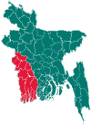
 Sarsha Location in Bangladesh | |
| Coordinates: 23°4.5′N 88°52′E / 23.0750°N 88.867°ECoordinates: 23°4.5′N 88°52′E / 23.0750°N 88.867°E | |
| Country |
|
| Division | Khulna Division |
| District | Jessore District |
| Area | |
| • Total | 336.34 km2 (129.86 sq mi) |
| Population (1991) | |
| • Total | 258,789 |
| • Density | 770/km2 (2,000/sq mi) |
| Time zone | BST (UTC+6) |
| Website | Official Map of Sharsha |
Sharsha (Bengali: শার্শা) is an Upazila of Jessore District in the Division of Khulna, Bangladesh.
Geography
Sharsha is located at 23°04′28″N 88°52′00″E / 23.0744°N 88.8667°E. It has 46,084 households and a total area of 336.34 km².
Sharsha Upazila is bounded by Bagdah community development block in North 24 Parganas district in West Bengal, India and Chaugachha, upazila on the north, Jhikargachha upazila on the east, Kalaroa upazila on the south and Bangaon and Gaighata community development blocks in North 24 Parganas district in West Bengal, India, on the west.[1]
Demographics
According to the 1991 Bangladesh census, Sharsha had a population of 258,789. Males comprised 51.4% of the population, and females 48.6%. The population aged 18 or over was 126,532. Sharsha had an average literacy rate of 25.5% (7+ years), compared to the national average of 32.4%.[2]
Administration
Sharsha has 11 Unions/Wards, 135 Mauzas/Mahallas, and 172 villages.
See also
References
- ↑ "Sharsha Upazila". Banglapedia. Retrieved 21 July 2016.
- ↑ "Population Census Wing, BBS.". Archived from the original on 2005-03-27. Retrieved November 10, 2006.
| Upazila/Thana: | ||
|---|---|---|