Tala Upazila
| Tala তালা | |
|---|---|
| Upazila | |
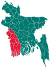
 Tala Location in Bangladesh | |
| Coordinates: 22°45′N 89°15′E / 22.750°N 89.250°ECoordinates: 22°45′N 89°15′E / 22.750°N 89.250°E | |
| Country |
|
| Division | Khulna Division |
| District | Satkhira District |
| Area | |
| • Total | 344.15 km2 (132.88 sq mi) |
| Population (1991) | |
| • Total | 251,388 |
| • Density | 730/km2 (1,900/sq mi) |
| Time zone | BST (UTC+6) |
| Climate | Aw |
| Website | Official Map of Tala Upazila |
Tala (Bengali: তালা) is an upazila of the Satkhira District in the Khulna Division of Bangladesh. It was established in 1913 and made an upazila in 1983.[1] Tala is located at 22°45′00″N 89°15′00″E / 22.7500°N 89.2500°E and has a total area of 344.15 km².
Demographics
As of the 1991 Bangladesh census, Tala has a population of 251388. 51.31% of the population is male, and 48.69% is female.[2]
Education
See also: Education in Bangladesh
According to Banglapedia, Kumira Multilateral High School, founded in 1902, is a notable secondary school.[1]
See also
References
- 1 2 Goldar, Ashraful Islam (2012). "Tala Upazila". In Islam, Sirajul; Jamal, Ahmed A. Banglapedia: National Encyclopedia of Bangladesh (Second ed.). Asiatic Society of Bangladesh.
- ↑ "Population Census Wing, BBS.". Archived from the original on 2005-03-27. Retrieved November 10, 2006.
| Wikimedia Commons has media related to Tala Upazila. |

Village road and rural area of village Bhagbah
| Upazila/Thana: | ||
|---|---|---|
This article is issued from Wikipedia - version of the 10/3/2016. The text is available under the Creative Commons Attribution/Share Alike but additional terms may apply for the media files.