Rampal Upazila
| Rampal রামপাল | |
|---|---|
| Upazila | |
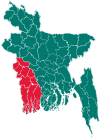
 Rampal Location in Bangladesh | |
| Coordinates: 22°34′N 89°39.8′E / 22.567°N 89.6633°ECoordinates: 22°34′N 89°39.8′E / 22.567°N 89.6633°E | |
| Country |
|
| Division | Khulna Division |
| District | Bagerhat District |
| Area | |
| • Total | 335.46 km2 (129.52 sq mi) |
| Population (1991) | |
| • Total | 167,070 |
| • Density | 500/km2 (1,300/sq mi) |
| Time zone | BST (UTC+6) |
| Website | Official Map of Rampal |
Rampal (Bengali: রামপাল) is an Upazila of Bagerhat District[1] in the Division of Khulna, Bangladesh.
Geography
Rampal is located at 22°34′00″N 89°39′50″E / 22.5667°N 89.6639°E . It has 33119 households and total area 335.46 km².
Demographics
As of the 1991 Bangladesh census, Rampal has a population of 167070. Males constitute 50.83% of the population, and females 49.17%. This Upazila's eighteen up population is 93518. Rampal has an average literacy rate of 45.5% (7+ years), and the national average of 32.4% literate.[2]
Economy
Most of the people here are gentle and educated.Rampal Upazila's economical condition is good. People are working in different sectors and contributing to our national development.The main jobs are fishing and cultivating.Also there are people working in abroad.
Administration
Rampal has 11 Unions/Wards, 140 Mauzas/Mahallas, and 149 villages.
Education
- Rampal Govt Degree College
- Abul Kalam Degree College
- Gilatola Secondary School
- Bastoli High School
- Kumlai High School
See also
References
- ↑ Moshfequr Rahman (2012), "Rampal Upazila", in Sirajul Islam and Ahmed A. Jamal, Banglapedia: National Encyclopedia of Bangladesh (Second ed.), Asiatic Society of Bangladesh
- ↑ "Population Census Wing, BBS.". Archived from the original on 2005-03-27. Retrieved November 10, 2006.
| Upazila/Thana: | ||
|---|---|---|