Morrelganj Upazila
| Morrelganj মোড়লগঞ্জ | |
|---|---|
| Upazila | |
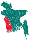
 Morrelganj Location in Bangladesh | |
| Coordinates: 22°27′N 89°51.5′E / 22.450°N 89.8583°ECoordinates: 22°27′N 89°51.5′E / 22.450°N 89.8583°E | |
| Country |
|
| Division | Khulna Division |
| District | Bagerhat District |
| Area | |
| • Total | 460.91 km2 (177.96 sq mi) |
| Population (1991) | |
| • Total | 321,153 |
| • Density | 700/km2 (1,800/sq mi) |
| Time zone | BST (UTC+6) |
| Website | Official Map of Morrelganj |
Morrelganj (Bengali: মোড়লগঞ্জ) is an Upazila of Bagerhat District[1] in the Division of Khulna, Bangladesh. Morrelganj (Town) consists of 9 wards and 12 mahallas. The area of the town is 15.36 km2. The town has a population of 22136; male 51.76%, female 48.24%. The density of population is 1441per km2. The town has one dak bungalow.
Morrelganj thana was established in 1909 and became an upazila in 1985. It consists of 1 municipality, 16 union parishads, 121 mouzas and 184 villages.
History
Morrelganj is named after the Morrel family. During the British rule Henry Morrel established Kuthi Bari and conducted torture in the area. In protest, a peasant rebellion spread under the leadership of Rahimullah of Baraikhali, who was killed on 25 November 1861.
During the War of Liberation 35 people were killed in an encounter between the freedom fighters and the Razakars on 15 August 1971. This is commemorated in the War of Liberation Memorial monument.
Geography
Morrelganj is located at 22°27′00″N 89°51′30″E / 22.4500°N 89.8583°E. It has 61210 household units and a total area 460.91 km².
Morrelganj Upazila (Bagerhat district) is bounded by Bagerhat sadar and Kachua upazilas on the north, Sarankhola and Mathbaria upazilas on the south, Pirojpur sadar and Bhandaria upazilas on the east, Rampal and Mongla upazilas on the west. Main rivers: Baleshwar, Ghasiakhali, Panguchi and Bhola.
Demographics
Population 321153; male 50.48% and female 49.52%; Muslim 86.59%, Hindu 13.28% and other 0.13%.
Economy
The main occupations are: Agriculture 35.49%, fishing 3.65%, agricultural labourer 20.73%, wage labourer 6.85%, commerce 11.85%, transport 1.4%, service 5.6%, others 14.43%.
There is a big Shopping Place in Morrelgonj Called Morrelgonj Center or Morrelgonj Bazar and it is the big Business place of Morrelgonj.
Land use
Cultivable land 31778.22 hectares; single crop 73.14%, double crop 15.30% and treble crop 11.56%.
Value of land Market value of first grade land is Tk 20000 per 0.01 hectare.
Main crops Paddy, potato, brinjal, sugarcane.
The sweet potato as a crop is extinct or nearly so.
The main cultivated fruits are mango, blackberry, jackfruit, guava, banana, palm and coconut.
Fisheries, dairies and poultry establishments: Fishery 960, poultry 13, dairy 8, hatchery 1.
Manufactures
Ice factory 4, rice mill 59, saw mill 46 and welding 30.
Cottage industries include: bamboo and cane work 144 and embroidery work 10.
Hats, bazars and fairs: Noted hats are Morrelganj, Daibogohati, Polerhat and Baharbunia College Bazar; noted fairs are Kalachand Aulia Mela, Laxmikhali Mela, Sanki Bhanga Baishakhi Mela and Baharbunia Halder Bari Namjagya.
Main exports Fish, betel nut, coconut and banana.
NGO activities brac, proshika, asa, Grameen bank, Bima Prokalpo, Ranar Uddipan, Mashuk, Gono Shastho Kendra, Dak Deya Jai, CDC.
Health centres
Morrelllgunge Upazila has a health complex, a satellite clinic, 16 health and family planning centres, a veterinary hospital and a private clinic.
Arts and culture
Morrelganj has a press club, two theatre groups, a public library, an opera party, and seven rural organisations.
Points of interest
Neelkuthi (1849) and Rajbari at Bonogram. The nearby Mosque City of Bagerhat, a UNESCO World Heritage site, is a formerly lost city, located in the suburbs of Bagerhat city in Bagerhat District, in the Khulna Division of southwest of Bangladesh. Bagerhat is about 15 miles south east of Khulna and 200 miles southwest of Dhaka. The mosque city is situated at the confluence of Ganges and Brahmaputra Rivers
Religious institutions Mosques 618, temples 65.
Administration
Morrelganj has 16 Unions/Wards, 122 Mauzas/Mahallas, and 184 villages.
Transport
Roads: Paved (pucca) 59 km, improved (semi pucca) 82 km and mud road 765 km. The traditional use of the palanquin for transportation is nearly extinct.
Education
The average literacy is 49.5%; of which male literacy is 53.9% and female literacy is 40%. Morrelganj has many educational institutions: college 6, high school 76, madrasa 291, most noted of which is S. M. University College (1968), Fulhata High School (1946), Daibajnahati BM High School (1915), AC Laha Pilot High School (1924), Bipin Kamol Balika Vidyalaya, Maa Babar Rhieen College, Hironmoy Halder Karigori College, Baharbunia, Nihar Halder Sanskrit College, Baharbunia, Baharbunia Halderbari Dakhil Mohila Madrasa,Suriyamukhi Halder Bari Reg. Prathomik Vidyalaya. Baharbuna KP sarkari prathomic vidyalaya.
Media
Morrelganj Barta (fortnightly), Mojlum (periodical) and weekly Royal Bengal (defunct). Another local newspaper is Namos Dut, edited and published by Bivash Das, Chitalmari, Bagerhat District.
See also
References
- ↑ Md. Shibbir Ahmed (2012), "Morrelganj Upazila", in Sirajul Islam and Ahmed A. Jamal, Banglapedia: National Encyclopedia of Bangladesh (Second ed.), Asiatic Society of Bangladesh
| Upazila/Thana: | ||
|---|---|---|