Jibannagar Upazila
| Jibannagar জীবননগর | |
|---|---|
| Upazila | |
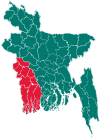
 Jibannagar Location in Bangladesh | |
| Coordinates: 23°25′N 88°49.2′E / 23.417°N 88.8200°ECoordinates: 23°25′N 88°49.2′E / 23.417°N 88.8200°E | |
| Country |
|
| Division | Khulna Division |
| District | Chuadanga District |
| Area | |
| • Total | 199.32 km2 (76.96 sq mi) |
| Population (1991) | |
| • Total | 125,102 |
| • Density | 628/km2 (1,630/sq mi) |
| Time zone | BST (UTC+6) |
| Website | Official Map of Jibannagar |
Jibannagar (Bengali: জীবননগর) is an Upazila of Chuadanga District[1] in the Division of Khulna, Bangladesh.
Geography
Jibannagar is located at 23°25′00″N 88°49′15″E / 23.4167°N 88.8208°E . It has 22628 households and total area 199.32 km².
Demographics
As of the 1991 Bangladesh census, Jibannagar has a population of 125102. Males constitute 51.32% of the population, and females 48.68%. This Upazila's eighteen up population is 61511. Jibannagar has an average literacy rate of 22.4% (7+ years), and the national average of 32.4% literate.[2]
Administration
Jibannagar Upazila with an area of 199.32 km2, is bounded by chuadanga sadar upazila on the north, maheshpur upazila on the south, kotchandpur upazila on the east, west Bengal of India on the west. Main rivers are bhairab and kobadak.
School
- B C K M P Secondary School
- Roypur Secondary School
- Hasadah Secondary School
- Uthali Secondary School
- Shaplakali Ideal School
- Jibannagar Degree College
- Jibannagar Girl's Degree College
See also
References
- ↑ Iman Siddiqui (2012), "Jibannagar Upazila", in Sirajul Islam and Ahmed A. Jamal, Banglapedia: National Encyclopedia of Bangladesh (Second ed.), Asiatic Society of Bangladesh
- ↑ "Population Census Wing, BBS.". Archived from the original on 2005-03-27. Retrieved November 10, 2006.
| Upazila/Thana: | ||
|---|---|---|