Magura Sadar Upazila
| Magura Sadar মাগুরা সদর | |
|---|---|
| Upazila | |
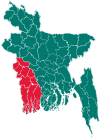
 Magura Sadar Location in Bangladesh | |
| Coordinates: 23°29.3′N 89°25.2′E / 23.4883°N 89.4200°ECoordinates: 23°29.3′N 89°25.2′E / 23.4883°N 89.4200°E | |
| Country |
|
| Division | Khulna Division |
| District | Magura District |
| Area | |
| • Total | 406.5 km2 (157.0 sq mi) |
| Population (2011) | |
| • Total | 380.107 |
| • Density | 706/km2 (1,830/sq mi) |
| Time zone | BST (UTC+6) |
| Website | Official Map of Magura Sadar |
Magura Sadar (Bengali: মাগুরা সদর) is an Upazila of Magura District[1] in the Division of Khulna, Bangladesh.
Geography
Magura Sadar is located at 23°29′15″N 89°25′15″E / 23.4875°N 89.4208°E. It has 50,041 households and a total area of 406.5 km².
Demographics
According to the 1991 Bangladesh census, Magura Sadar had a population of 286925. Males constituted 51.41% of the population, and females 48.59%. The population aged 18 or over was 145,777. Magura Sadar had an average literacy rate of 29.6% (7+ years), compared to the national average of 32.4%.[2]
Administration
Magura Sadar has 13 Unions, 263 Mauzas/Mahallas, and 252 villages.
See also
References
- ↑ Ranjit Kumar Basu (2012), "Magura Sadar Upazila", in Sirajul Islam and Ahmed A. Jamal, Banglapedia: National Encyclopedia of Bangladesh (Second ed.), Asiatic Society of Bangladesh
- ↑ "Population Census Wing, BBS.". Archived from the original on 2005-03-27. Retrieved November 10, 2006.
| Upazila/Thana: | ||
|---|---|---|
This article is issued from Wikipedia - version of the 9/9/2016. The text is available under the Creative Commons Attribution/Share Alike but additional terms may apply for the media files.