Heumen
| Heumen | |||
|---|---|---|---|
| Municipality | |||
|
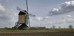
Windmill near Overasselt | |||
| |||
.svg.png) Location in Gelderland | |||
| Coordinates: 51°47′N 5°51′E / 51.783°N 5.850°ECoordinates: 51°47′N 5°51′E / 51.783°N 5.850°E | |||
| Country | Netherlands | ||
| Province | Gelderland | ||
| Government[1] | |||
| • Body | Municipal council | ||
| • Mayor | Paul Mengde (PvdA) | ||
| Area[2] | |||
| • Total | 41.54 km2 (16.04 sq mi) | ||
| • Land | 39.85 km2 (15.39 sq mi) | ||
| • Water | 1.69 km2 (0.65 sq mi) | ||
| Elevation[3] | 11 m (36 ft) | ||
| Population (May 2014)[4] | |||
| • Total | 16,384 | ||
| • Density | 411/km2 (1,060/sq mi) | ||
| Demonym(s) | Heumenaar | ||
| Time zone | CET (UTC+1) | ||
| • Summer (DST) | CEST (UTC+2) | ||
| Postcode | 6580–6582, 6610–6612 | ||
| Area code | 024 | ||
| Website |
www | ||


Heumen (![]() pronunciation ) is a municipality and a village in the eastern Netherlands.
pronunciation ) is a municipality and a village in the eastern Netherlands.
Population centres
- Heumen
- Malden (administrative centre)
- Molenhoek (partly)
- Nederasselt
- Overasselt
Topography
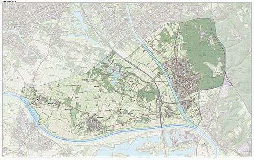
Dutch Topographic map of the municipality of Heumen, June 2015
Gallery
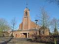 Heumen, the catholic church
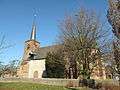 Heumen, the reformed church
References
- ↑ "Samenstelling college" [Members of the board] (in Dutch). Gemeente Heumen. Retrieved 8 July 2014.
- ↑ "Kerncijfers wijken en buurten" [Key figures for neighbourhoods]. CBS Statline (in Dutch). CBS. 2 July 2013. Retrieved 12 March 2014.
- ↑ "Postcodetool for 6581AC". Actueel Hoogtebestand Nederland (in Dutch). Het Waterschapshuis. Retrieved 8 July 2014.
- ↑ "Bevolkingsontwikkeling; regio per maand" [Population growth; regions per month]. CBS Statline (in Dutch). CBS. 26 June 2014. Retrieved 24 July 2014.
External links
 Media related to Heumen at Wikimedia Commons
- Official website
 |
Wijchen | Nijmegen | | |
| |
Berg en Dal | |||
| ||||
| | ||||
| Maas River Grave (NB) |
Maas River Cuijk (NB) |
Mook en Middelaar (LI) |

This article is issued from Wikipedia - version of the 1/8/2016. The text is available under the Creative Commons Attribution/Share Alike but additional terms may apply for the media files.