Lingewaard
| Lingewaard | |||
|---|---|---|---|
| Municipality | |||
|
Lingewaard city hall | |||
| |||
.svg.png) Location in Gelderland | |||
| Coordinates: 51°53′N 5°54′E / 51.883°N 5.900°ECoordinates: 51°53′N 5°54′E / 51.883°N 5.900°E | |||
| Country | Netherlands | ||
| Province | Gelderland | ||
| Government[1] | |||
| • Body | Municipal council | ||
| • Mayor | Marianne Schuurmans (VVD) | ||
| Area[2] | |||
| • Total | 69.14 km2 (26.70 sq mi) | ||
| • Land | 62.23 km2 (24.03 sq mi) | ||
| • Water | 6.91 km2 (2.67 sq mi) | ||
| Elevation[3] | 11 m (36 ft) | ||
| Population (May 2014)[4] | |||
| • Total | 45,768 | ||
| • Density | 735/km2 (1,900/sq mi) | ||
| Time zone | CET (UTC+1) | ||
| • Summer (DST) | CEST (UTC+2) | ||
| Postcode | 6680–6681, 6684–6691, 6850–6852 | ||
| Area code | 026, 0481 | ||
| Website |
www | ||
_gemeentehuis%2C_voormalig_kloostercomplex.JPG)

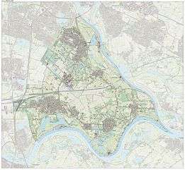
Lingewaard (![]() pronunciation ) is a municipality in the eastern Netherlands. It is located in the most eastern part of the Betuwe. It was formed in 2001 as a merger between Bemmel, Gendt and Huissen. The municipality was initially named Bemmel after the largest former municipality but later renamed in a referendum. "Lingewaard" itself is not a population centre, but an artificial name favoured by the majority of the voters. The municipality lies in between of the cities of Nijmegen and Arnhem, where most inhabitants work.
pronunciation ) is a municipality in the eastern Netherlands. It is located in the most eastern part of the Betuwe. It was formed in 2001 as a merger between Bemmel, Gendt and Huissen. The municipality was initially named Bemmel after the largest former municipality but later renamed in a referendum. "Lingewaard" itself is not a population centre, but an artificial name favoured by the majority of the voters. The municipality lies in between of the cities of Nijmegen and Arnhem, where most inhabitants work.
Population centres
The municipality has the following population centres:
| Cities/villages | Population[5] |
|---|---|
| Huissen | 18.254 |
| Bemmel | 12.577 |
| Gendt | 7.198 |
| Angeren | 2.864 |
| Doornenburg | 2.729 |
| Haalderen | 2.040 |
| Loo | 1980 |
| Ressen | 119 |
Bemmel also includes the hamlet and former village of Doornik. Gendt includes Hulhuizen.
Notable residents
Notable people from the municipality of Lingewaard include:
- Stijn Schaars, footballer, currently at PSV (born in Gendt).
Twin towns
Lingewaard is twinned with:
References
- ↑ "Samenstelling college van B&W" [Members of the board of mayor and aldermen] (in Dutch). Gemeente Lingewaard. Retrieved 8 July 2014.
- ↑ "Kerncijfers wijken en buurten" [Key figures for neighbourhoods]. CBS Statline (in Dutch). CBS. 2 July 2013. Retrieved 12 March 2014.
- ↑ "Postcodetool for 6681BJ". Actueel Hoogtebestand Nederland (in Dutch). Het Waterschapshuis. Retrieved 8 July 2014.
- ↑ "Bevolkingsontwikkeling; regio per maand" [Population growth; regions per month]. CBS Statline (in Dutch). CBS. 26 June 2014. Retrieved 24 July 2014.
- ↑ Inhabitants 1 January 2012 according to the website of the municipality of Lingewaard.
- ↑ Mizil-Lingewaard Twinning site; accessed September 14, 2010
External links
 Media related to Lingewaard at Wikimedia Commons
- Official website
 |
Arnhem, Westervoort | Duiven | | |
| Overbetuwe | |
Rijnwaarden | ||
| ||||
| | ||||
| Nijmegen | Waal Berg en Dal |
Waal |
