Bennecourt
| Bennecourt | ||
|---|---|---|
|
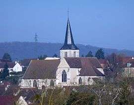
The church of Saint-Ouen, in Bennecourt | ||
| ||
 Bennecourt | ||
|
Location within Île-de-France region  Bennecourt | ||
| Coordinates: 49°02′24″N 1°33′47″E / 49.040°N 1.563°ECoordinates: 49°02′24″N 1°33′47″E / 49.040°N 1.563°E | ||
| Country | France | |
| Region | Île-de-France | |
| Department | Yvelines | |
| Arrondissement | Mantes-la-Jolie | |
| Canton | Bonnières-sur-Seine | |
| Intercommunality | Portes de l'Île-de-France | |
| Government | ||
| • Mayor (2001–2008) | Didier Dumont | |
| Area1 | 6.95 km2 (2.68 sq mi) | |
| Population (2006)2 | 1,796 | |
| • Density | 260/km2 (670/sq mi) | |
| Time zone | CET (UTC+1) | |
| • Summer (DST) | CEST (UTC+2) | |
| INSEE/Postal code | 78057 / 78270 | |
| Elevation |
10–120 m (33–394 ft) (avg. 19 m or 62 ft) | |
|
1 French Land Register data, which excludes lakes, ponds, glaciers > 1 km² (0.386 sq mi or 247 acres) and river estuaries. 2 Population without double counting: residents of multiple communes (e.g., students and military personnel) only counted once. | ||

Bennecourt is a commune in the Yvelines department in north-central France.
See also
References
| Wikimedia Commons has media related to Bennecourt. |
This article is issued from Wikipedia - version of the 9/17/2015. The text is available under the Creative Commons Attribution/Share Alike but additional terms may apply for the media files.