Chapet
| Chapet | |
|---|---|
|
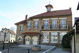
Town hall | |
 Chapet | |
|
Location within Île-de-France region  Chapet | |
| Coordinates: 48°58′02″N 1°56′04″E / 48.9672°N 1.9344°ECoordinates: 48°58′02″N 1°56′04″E / 48.9672°N 1.9344°E | |
| Country | France |
| Region | Île-de-France |
| Department | Yvelines |
| Arrondissement | Mantes-la-Jolie |
| Canton | Meulan |
| Intercommunality | Deux rives de la Seine |
| Government | |
| • Mayor (2001–2008) | Michel Sorain |
| Area1 | 5.10 km2 (1.97 sq mi) |
| Population (2006)2 | 1,187 |
| • Density | 230/km2 (600/sq mi) |
| Time zone | CET (UTC+1) |
| • Summer (DST) | CEST (UTC+2) |
| INSEE/Postal code | 78140 / 78130 |
| Elevation |
29–121 m (95–397 ft) (avg. 59 m or 194 ft) |
|
1 French Land Register data, which excludes lakes, ponds, glaciers > 1 km² (0.386 sq mi or 247 acres) and river estuaries. 2 Population without double counting: residents of multiple communes (e.g., students and military personnel) only counted once. | |
Chapet is a commune in the Yvelines department in the Île-de-France in north-central France, about 16 km east of Mantes-la-Jolie. It is on the Normandy motorway (A13).
The commune's neighbours are Verneuil-sur-Seine to the northeast, to the east is Vernouillet, with Morainvilliers to the southeast, Ecquevilly to the southwest, and to the northwest is Mureaux.
It is a largely rural and agricultural community; the land is divided mainly between arable crops (cereals, oilseed rape) with some woods and forest.
The parish church of Saint-Denis dates from the 12th century. The bell-tower was added in 1859.
See also
References
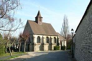
Saint-Denis
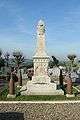 War memorial
 Grande Rue
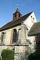 Belfry
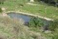 Pond
Pond
| Wikimedia Commons has media related to Chapet. |
This article is issued from Wikipedia - version of the 11/1/2014. The text is available under the Creative Commons Attribution/Share Alike but additional terms may apply for the media files.