Hermeray
| Hermeray | ||
|---|---|---|
|
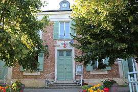
The town hall in Hermeray | ||
| ||
 Hermeray | ||
|
Location within Île-de-France region  Hermeray | ||
| Coordinates: 48°39′02″N 1°41′20″E / 48.6506°N 1.6889°ECoordinates: 48°39′02″N 1°41′20″E / 48.6506°N 1.6889°E | ||
| Country | France | |
| Region | Île-de-France | |
| Department | Yvelines | |
| Arrondissement | Rambouillet | |
| Canton | Rambouillet | |
| Intercommunality | Plaines et forêts d'Yveline | |
| Government | ||
| • Mayor (2008–2014) | Alain Jeulain | |
| Area1 | 18.07 km2 (6.98 sq mi) | |
| Population (2006)2 | 919 | |
| • Density | 51/km2 (130/sq mi) | |
| Time zone | CET (UTC+1) | |
| • Summer (DST) | CEST (UTC+2) | |
| INSEE/Postal code | 78307 / 78125 | |
| Elevation |
119–174 m (390–571 ft) (avg. 134 m or 440 ft) | |
|
1 French Land Register data, which excludes lakes, ponds, glaciers > 1 km² (0.386 sq mi or 247 acres) and river estuaries. 2 Population without double counting: residents of multiple communes (e.g., students and military personnel) only counted once. | ||

Hermeray is a commune in the Yvelines département in the Île-de-France region in north-central France.
See also
References
| Wikimedia Commons has media related to Hermeray. |
This article is issued from Wikipedia - version of the 2/17/2015. The text is available under the Creative Commons Attribution/Share Alike but additional terms may apply for the media files.