Blaru
| Blaru | |
|---|---|
|
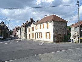
A view within Blaru | |
 Blaru | |
|
Location within Île-de-France region  Blaru | |
| Coordinates: 49°02′56″N 1°28′44″E / 49.049°N 1.479°ECoordinates: 49°02′56″N 1°28′44″E / 49.049°N 1.479°E | |
| Country | France |
| Region | Île-de-France |
| Department | Yvelines |
| Arrondissement | Mantes-la-Jolie |
| Canton | Bonnières-sur-Seine |
| Intercommunality | Portes de l’Île-de-France |
| Government | |
| • Mayor (2001–2008) | Joëlle Rollin |
| Area1 | 14.84 km2 (5.73 sq mi) |
| Population (2006)2 | 946 |
| • Density | 64/km2 (170/sq mi) |
| Time zone | CET (UTC+1) |
| • Summer (DST) | CEST (UTC+2) |
| INSEE/Postal code | 78068 / 78270 |
| Elevation |
50–152 m (164–499 ft) (avg. 90 m or 300 ft) |
|
1 French Land Register data, which excludes lakes, ponds, glaciers > 1 km² (0.386 sq mi or 247 acres) and river estuaries. 2 Population without double counting: residents of multiple communes (e.g., students and military personnel) only counted once. | |
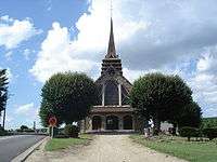
Saint-Hilaire
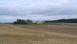
Priory of Béthanie
Blaru is a commune in the Yvelines department in north-central France.
See also
References
| Wikimedia Commons has media related to Blaru. |
This article is issued from Wikipedia - version of the 9/17/2015. The text is available under the Creative Commons Attribution/Share Alike but additional terms may apply for the media files.