Lévis-Saint-Nom
| Lévis-Saint-Nom | ||
|---|---|---|
|
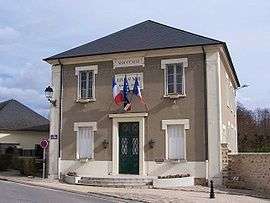
Town hall | ||
| ||
 Lévis-Saint-Nom | ||
|
Location within Île-de-France region  Lévis-Saint-Nom | ||
| Coordinates: 48°43′20″N 1°56′58″E / 48.7222°N 1.9494°ECoordinates: 48°43′20″N 1°56′58″E / 48.7222°N 1.9494°E | ||
| Country | France | |
| Region | Île-de-France | |
| Department | Yvelines | |
| Arrondissement | Rambouillet | |
| Canton | Chevreuse | |
| Government | ||
| • Mayor (2001–2008) | Yves Vanderwalle | |
| Area1 | 8.25 km2 (3.19 sq mi) | |
| Population (2006)2 | 1,790 | |
| • Density | 220/km2 (560/sq mi) | |
| Time zone | CET (UTC+1) | |
| • Summer (DST) | CEST (UTC+2) | |
| INSEE/Postal code | 78334 / 78320 | |
| Elevation |
103–174 m (338–571 ft) (avg. 142 m or 466 ft) | |
|
1 French Land Register data, which excludes lakes, ponds, glaciers > 1 km² (0.386 sq mi or 247 acres) and river estuaries. 2 Population without double counting: residents of multiple communes (e.g., students and military personnel) only counted once. | ||
.svg.png)
Lévis-Saint-Nom is a commune in the Yvelines department in the Île-de-France region in north-central France.
See also
References
| Wikimedia Commons has media related to Lévis-Saint-Nom. |
This article is issued from Wikipedia - version of the 2/17/2015. The text is available under the Creative Commons Attribution/Share Alike but additional terms may apply for the media files.