Achères, Yvelines
| Achères | ||
|---|---|---|
|
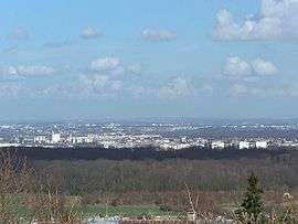
A general view of Achères | ||
| ||
 Location (in red) within Paris inner and outer suburbs | ||
| Coordinates: 48°57′37″N 2°04′06″E / 48.9602°N 2.0684°ECoordinates: 48°57′37″N 2°04′06″E / 48.9602°N 2.0684°E | ||
| Country | France | |
| Region | Île-de-France | |
| Department | Yvelines | |
| Arrondissement | Saint-Germain-en-Laye | |
| Government | ||
| • Mayor (2008–2014) | Alain Outreman | |
| Area1 | 9.44 km2 (3.64 sq mi) | |
| Population (2008)2 | 19,733 | |
| • Density | 2,100/km2 (5,400/sq mi) | |
| Time zone | CET (UTC+1) | |
| • Summer (DST) | CEST (UTC+2) | |
| INSEE/Postal code | 78005 / | |
| Elevation | 18–32 m (59–105 ft) | |
|
1 French Land Register data, which excludes lakes, ponds, glaciers > 1 km² (0.386 sq mi or 247 acres) and river estuaries. 2 Population without double counting: residents of multiple communes (e.g., students and military personnel) only counted once. | ||
.svg.png)
Achères is a commune in the Yvelines department in north-central France. It is located 23.7 km (14.7 mi) from the center of Paris.
The commune of Achères lies on the south bank of the Seine in a loop of the river, on the edge of the Forest of Saint-Germain-en-Laye. It borders Saint-Germain-en-Laye and Poissy on the south, Andrésy and Carrières-sous-Poissy on the west, Conflans-Sainte-Honorine and Herblay on the north, and Maisons-Laffitte and La Frette-sur-Seine on the east.

Population
| Historical population | ||
|---|---|---|
| Year | Pop. | ±% |
| 1793 | 349 | — |
| 1800 | 415 | +18.9% |
| 1806 | 416 | +0.2% |
| 1821 | 433 | +4.1% |
| 1831 | 479 | +10.6% |
| 1836 | 506 | +5.6% |
| 1841 | 508 | +0.4% |
| 1846 | 553 | +8.9% |
| 1851 | 585 | +5.8% |
| 1856 | 595 | +1.7% |
| 1861 | 660 | +10.9% |
| 1866 | 648 | −1.8% |
| 1872 | 715 | +10.3% |
| 1876 | 853 | +19.3% |
| 1881 | 874 | +2.5% |
| 1886 | 847 | −3.1% |
| 1891 | 801 | −5.4% |
| 1896 | 944 | +17.9% |
| 1901 | 1,158 | +22.7% |
| 1906 | 1,260 | +8.8% |
| 1911 | 1,496 | +18.7% |
| 1921 | 1,703 | +13.8% |
| 1926 | 2,374 | +39.4% |
| 1931 | 3,109 | +31.0% |
| 1936 | 3,641 | +17.1% |
| 1946 | 3,936 | +8.1% |
| 1954 | 4,459 | +13.3% |
| 1962 | 5,390 | +20.9% |
| 1968 | 10,444 | +93.8% |
| 1975 | 15,172 | +45.3% |
| 1982 | 15,351 | +1.2% |
| 1990 | 15,039 | −2.0% |
| 1999 | 18,929 | +25.9% |
| 2008 | 19,733 | +4.2% |
Inhabitants of Achères are called Achérois.
Transportation
Achères is served by Achères – Ville station on Paris RER line ![]() and on the Transilien Paris – Saint-Lazare suburban rail line, called line L.
and on the Transilien Paris – Saint-Lazare suburban rail line, called line L.
By road, it is accessible from the N184, the Route de Poissy, and the D30.
See also
References
External links
| Wikimedia Commons has media related to Achères, Yvelines. |
- Official website (French)