Civry-la-Forêt
| Civry-la-Forêt | |
|---|---|
|
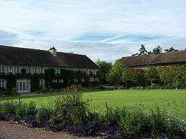
The golf club in Civry-la-Forêt | |
 Civry-la-Forêt | |
|
Location within Île-de-France region  Civry-la-Forêt | |
| Coordinates: 48°52′03″N 1°37′01″E / 48.8675°N 1.6169°ECoordinates: 48°52′03″N 1°37′01″E / 48.8675°N 1.6169°E | |
| Country | France |
| Region | Île-de-France |
| Department | Yvelines |
| Arrondissement | Mantes-la-Jolie |
| Canton | Houdan |
| Intercommunality | Pays houdanais |
| Government | |
| • Mayor (2001–2008) | Jean-Louis Aubert |
| Area1 | 9.40 km2 (3.63 sq mi) |
| Population (2006)2 | 334 |
| • Density | 36/km2 (92/sq mi) |
| Time zone | CET (UTC+1) |
| • Summer (DST) | CEST (UTC+2) |
| INSEE/Postal code | 78163 / 78910 |
| Elevation |
80–157 m (262–515 ft) (avg. 126 m or 413 ft) |
|
1 French Land Register data, which excludes lakes, ponds, glaciers > 1 km² (0.386 sq mi or 247 acres) and river estuaries. 2 Population without double counting: residents of multiple communes (e.g., students and military personnel) only counted once. | |
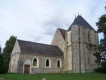
Saint-Barthélemy
Civry-la-Forêt is a commune in the Yvelines department in the Île-de-France region in north-central France.
See also
References
| Wikimedia Commons has media related to Civry-la-Forêt. |
This article is issued from Wikipedia - version of the 2/16/2015. The text is available under the Creative Commons Attribution/Share Alike but additional terms may apply for the media files.