Cherry Valley Village Historic District
|
Cherry Valley Village Historic District | |
|
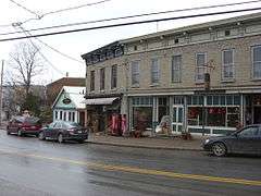
Cherry Valley Village Historic District, November 2008 | |
  | |
| Location | Roughly bounded by Alden St. and Montgomery St., Maple Ave. and Elm St., and Main St., Cherry Valley, New York |
|---|---|
| Coordinates | 42°47′48″N 74°45′9″W / 42.79667°N 74.75250°WCoordinates: 42°47′48″N 74°45′9″W / 42.79667°N 74.75250°W |
| Area | 95 acres (38 ha) |
| Architect | Multiple |
| Architectural style | Greek Revival, Italianate, Federal |
| NRHP Reference # | 88000472[1] |
| Added to NRHP | April 28, 1988 |
|
Lindesay Patent Rural Historic District (Boundary Increase) | |
|
| |
| Location | Roughly bounded by US 20, NY 166, Fields Rd., O'Neil Rd., Co. Rd. 33 and Shipway Rd., Cherry Valley, New York |
|---|---|
| Coordinates | 42°50′57″N 74°46′47″W / 42.84917°N 74.77972°W |
| Area | 9,105 acres (3,685 ha) |
| Built | 1778 |
| Architectural style | Late Victorian, Mid 19th Century Revival, Federal |
| NRHP Reference # | 95001024 |
| Added to NRHP | August 18, 1995[1] |
Cherry Valley Village Historic District is a national historic district in Cherry Valley in Otsego County, New York. It was listed on the National Register of Historic Places in 1988. It encompasses 226 contributing buildings, one contributing site, three contributing structures, and two contributing objects.[1][2] Its boundaries were increased in 1995, by an area called the Lindesay Patent Rural Historic District. It encompasses 331 contributing buildings.[3]
References
- 1 2 3 National Park Service (2009-03-13). "National Register Information System". National Register of Historic Places. National Park Service.
- ↑ Mark Peckham (August 1987). "National Register of Historic Places Registration: Cherry Valley Village Historic District". New York State Office of Parks, Recreation and Historic Preservation. Retrieved 2010-01-14. See also: "Accompanying 52 photos".
- ↑ unknown (n.d.). "National Register of Historic Places Registration: Lindesay Patent Rural Historic District". New York State Office of Parks, Recreation and Historic Preservation. Retrieved 2010-01-14. See also: "Accompanying 88 photos".
| Topics |   | |
|---|---|---|
| Lists by county |
| |
| Lists by city | ||
| Other lists | ||
| ||
This article is issued from Wikipedia - version of the 11/27/2016. The text is available under the Creative Commons Attribution/Share Alike but additional terms may apply for the media files.