Laurel, Mississippi
| Laurel, Mississippi | |
|---|---|
| City | |
|
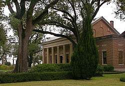
Lauren Rogers Museum of Art in Laurel | |
| Nickname(s): "The City Beautiful" | |
 Location of Laurel in the State of Mississippi | |
 Laurel, Mississippi Location in the United States | |
| Coordinates: 31°41′51″N 89°8′22″W / 31.69750°N 89.13944°WCoordinates: 31°41′51″N 89°8′22″W / 31.69750°N 89.13944°W | |
| Country | United States |
| State | Mississippi |
| County | Jones |
| Incorporated | 1882 |
| Government | |
| • Type | Mayor-Council |
| • Mayor | Johnny Magee |
| Area | |
| • Total | 15.8 sq mi (40.8 km2) |
| • Land | 15.4 sq mi (40.0 km2) |
| • Water | 0.3 sq mi (0.9 km2) |
| Elevation | 269 ft (82 m) |
| Population (2012) | |
| • Total | 18,838 |
| • Density | 1,203.90/sq mi (463.5/km2) |
| Time zone | CST (UTC-6) |
| • Summer (DST) | CDT (UTC-5) |
| ZIP codes | 39440–39443 |
| Area code(s) | 601 |
| FIPS code | 28-39640 |
| GNIS feature ID | 0672321 |
| Website | www.LaurelMS.com |
Laurel is a city in and the second county seat of Jones County, Mississippi, United States. As of the 2010 census, the city had a total population of 18,548. It is located northeast of Ellisville, the first county seat, which contains the county courthouse.
Laurel is the principal city of a Micropolitan Statistical Area named for it. Its major employers include Howard Industries, Sanderson Farms, Masonite, Family Health Center, Howse Implement, Thermo-Kool and South Central Regional Medical Center. Laurel is home to the Lauren Rogers Museum of Art, Mississippi's oldest art museum, which was established by a family that made its wealth in timber.
It is the headquarters of the Jones County Sheriff's Department, which administers in the county.
History
.jpg)
Laurel was founded in 1882 as a lumber town, as the industry harvested yellow pine forests in the region. The city was named for laurel thickets near the original town site.[1]
By the turn of the century, the city became a site of cotton mills, to process and manufacture textiles from the state's commodity crop of cotton. The city population grew markedly during the early 20th century, as rural people were attracted to manufacturing jobs. Mechanization of agriculture reduced the number of farming jobs. The city reached its peak of population in 1960, and has declined about one third since then.
Geography
According to the United States Census Bureau, the city has a total area of 15.8 square miles (41 km2), of which 15.4 square miles (40 km2) is land and 0.3 square miles (0.78 km2), or 2.09%, is water.
Climate
The climate in this area is characterized by hot, humid summers and generally mild to cool winters. According to the Köppen Climate Classification system, Laurel has a humid subtropical climate, abbreviated "Cfa" on climate maps.[2]
Demographics
| Historical population | |||
|---|---|---|---|
| Census | Pop. | %± | |
| 1900 | 3,193 | — | |
| 1910 | 8,465 | 165.1% | |
| 1920 | 13,037 | 54.0% | |
| 1930 | 18,017 | 38.2% | |
| 1940 | 20,598 | 14.3% | |
| 1950 | 25,038 | 21.6% | |
| 1960 | 27,889 | 11.4% | |
| 1970 | 24,145 | −13.4% | |
| 1980 | 21,897 | −9.3% | |
| 1990 | 18,827 | −14.0% | |
| 2000 | 18,393 | −2.3% | |
| 2010 | 18,540 | 0.8% | |
| Est. 2015 | 18,837 | [3] | 1.6% |
| U.S. Decennial Census[4] 2012 Estimate[5] | |||
As of the census[6] of 2000, there were 18,393 people, 6,925 households, and 4,542 families residing in the city. The population density was 1,192.3 people per square mile (460.2/km²). There were 7,804 housing units at an average density of 505.9 per square mile (195.3/km²). The racial makeup of the city was 40.64% White, 55.08% African American, 0.11% Native American, 0.33% Asian, 0.01% Pacific Islander, 3.17% from other races, and 0.67% from two or more races. Hispanic or Latino of any race were 3.87% of the population.
There were 6,925 households out of which 29.7% had children under the age of 18 living with them, 37.2% were married couples living together, 23.5% had a female householder with no husband present, and 34.4% were non-families. 30.1% of all households were made up of individuals and 14.4% had someone living alone who was 65 years of age or older. The average household size was 2.61 and the average family size was 3.21.
In the city the population was spread out with 27.9% under the age of 18, 10.1% from 18 to 24, 25.4% from 25 to 44, 19.4% from 45 to 64, and 17.2% who were 65 years of age or older. The median age was 35 years. For every 100 females there were 85.8 males. For every 100 females age 18 and over, there were 80.5 males.
The median income for a household in the city was $25,988, and the median income for a family was $30,185. Males had a median income of $27,077 versus $17,336 for females. The per capita income for the city was $15,561. 28.9% of the population and 21.4% of families were below the poverty line. 37.5% of those under the age of 18 and 19.3% of those 65 and older were living below the poverty line.
Government
City government consists of a mayor-council form. The mayor is elected at-large. Council members are elected from single-member districts.
- City Officials
- Johnny Magee – Mayor
- La'Juan Jones – Ward 1 Councilman
- Tony Wheat – Ward 2 Councilman
- Tony Thaxton – Ward 3 Councilman
- George Carmichael – Ward 4 Councilman
- Manuel L. Jones – Ward 5 Councilman
- Travares Comegys – Ward 6 Councilman
- David Wash – Ward 7 Councilman
The United States Postal Service operates the Laurel Post Office and the Choctaw Post Office, both located in Laurel.[7][8]
The Mississippi Department of Mental Health South Mississippi State Hospital Crisis Intervention Center is in Laurel.[9]
Education
Public schools
- Laurel School District
- Jones County School District
Private schools
- Immaculate Conception School (now closed)
- Laurel Christian School
- Laurel Christian High School
- St. John's Day School (affiliated with the Episcopal Church)
Media
- WDAM-TV
- WHLT-TV
- The Laurel Leader-Call newspaper
- The Chronicle[10]
- WXRR (104.5 FM, "Rock104")
- WBBN (95.9 FM, "B-95")
- Impact Laurel[11]
Infrastructure
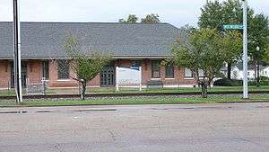
Amtrak's Crescent train connects Laurel with the cities of New York, Philadelphia, Baltimore, Washington, Charlotte, Atlanta, Birmingham and New Orleans. The Amtrak station is situated at 230 North Maple Street.
Hattiesburg-Laurel Regional Airport is located in an unincorporated area in Jones County, near Moselle.[12][13]
- Major highways
Notable people
- Jake Allen, professional football player
- Lance Bass, musician
- Marsha Blackburn, U.S. Representative from Tennessee
- Ralph Boston, Olympic champion athlete
- Jason Campbell, professional football player
- David and the Giants, Christian rock band
- Akeem Davis, professional football player
- Mary Elizabeth Ellis, actress
- Carroll Gartin, former lieutenant governor
- Ed Hinton, sportswriter
- Tess Holliday, plus-size model
- Robert Hyatt, computer scientist
- Mark A. Landis, art forger
- Tom Lester, television actor
- Mundell Lowe, jazz musician
- Doug Marlette, Pulitzer Prize-winning cartoonist
- Charles Marsh, writer, theologian, and biographer of Dietrich Bonhoeffer[14][15]
- Chris McDaniel, attorney and politician
- Mary Mills, professional golfer
- Kenny Payne, former professional basketball player
- Charles W. Pickering, politician and judge
- Chip Pickering, former U.S. Representative
- Stacey Pickering, State Auditor of Mississippi
- Clinton Portis, former professional football player
- Parker Posey, actress
- Leontyne Price, opera singer
- Omeria McDonald Scott, State representative
- Lloyd Wells, musician
References
- ↑ Gannett, Henry (1905). The Origin of Certain Place Names in the United States. U.S. Government Printing Office. p. 182.
- ↑ Climate Summary for Laurel, Mississippi
- ↑ "Annual Estimates of the Resident Population for Incorporated Places: April 1, 2010 to July 1, 2015". Retrieved July 2, 2016.
- ↑ United States Census Bureau. "Census of Population and Housing". Retrieved September 2, 2013.
- ↑ "Annual Estimates of the Resident Population: April 1, 2010 to July 1, 2012". Retrieved September 2, 2013.
- ↑ "American FactFinder". United States Census Bureau. Retrieved 2008-01-31.
- ↑ "Post Office Location – LAUREL." United States Postal Service. Retrieved on November 1, 2010.
- ↑ "Post Office Location - CHOCTAW." United States Postal Service. Retrieved on November 1, 2010.
- ↑ "Contact Us." South Mississippi State Hospital. Retrieved on November 1, 2010. "SMSH Crisis Intervention Center 934 West Drive Laurel, MS 39440."
- ↑ "The Chronicle". Retrieved June 6, 2016.
- ↑ "IMPACT". Retrieved June 6, 2016.
- ↑ "Contact." Hattiesburg-Laurel Regional Airport. Retrieved on July 15, 2011. "Our Address Airport Director, 1002 Terminal Dr. Moselle, MS 39459"
- ↑ "Hattiesburg city, Mississippi." U.S. Census Bureau. Retrieved on July 16, 2011.
- ↑ "Charles Marsh". Mississippi Writers & Musicians. Retrieved October 28, 2015.
- ↑ "Book Discussion on 'The Last Days: A Son's Story of Sin and Segregation'". C-SPAN. March 19, 2001. Retrieved October 28, 2015.
Further reading
- Alex Heard, The Eyes of Willie McGee: A Tragedy of Race, Sex and Secrets in the Jim Crow South (New York: Harper, 2011)
- Nollie W. Hickman, Mississippi Harvest: Lumbering in the Longleaf Pine Belt, 1840-1915 (Jackson: University Press of Mississippi, new edition, 2009)
- Gilbert H. Hoffman and Tony Howe, Yellow Pine Capital: The Laurel, Mississippi Story (Toot Toot Publishing Company, 2010)
- Charles Marsh, The Last Days: A Son's Story of Sin and Segregation at the Dawn of a New South (New York: Basic Books, 2000)
- Cleveland Payne, The Oak Park Story: A Cultural History, 1928-1970 (National Oak Park High School Alumni Association, 1988.
- Cleveland Payne, Laurel: A History of the Black Community, 1882-1962(Cleveland Payne, 1990)
External links
- City of Laurel
- History of Laurel's Jewish community, Institute of Southern Jewish Life
- Scrapbook re: Laurel, Mississippi (MUM00404), owned by the University of Mississippi.
Municipalities and communities of Jones County, Mississippi, United States | ||
|---|---|---|
| Cities | 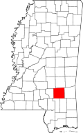 | |
| Towns | ||
| CDP |
| |
| Other unincorporated communities | ||
.svg.png)