Madison County, Mississippi
| Madison County, Mississippi | |
|---|---|
 Madison County courthouse in Canton | |
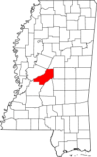 Location in the U.S. state of Mississippi | |
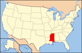 Mississippi's location in the U.S. | |
| Founded | January 29, 1828 |
| Named for | James Madison |
| Seat | Canton |
| Largest city | Ridgeland |
| Area | |
| • Total | 742 sq mi (1,922 km2) |
| • Land | 715 sq mi (1,852 km2) |
| • Water | 27 sq mi (70 km2), 3.7% |
| Population (est.) | |
| • (2014) | 101,688 |
| Congressional districts | 2nd, 3rd |
| Time zone | Central: UTC-6/-5 |
| Website |
www |
Madison County is a county located in the U.S. state of Mississippi. As of the 2010 census, the population was 95,203.[1] The county seat is Canton.[2] The county is named for U.S. President James Madison.[3]
Madison County is part of the Jackson, MS Metropolitan Statistical Area.
Geography
According to the U.S. Census Bureau, the county has a total area of 742 square miles (1,920 km2), of which 715 square miles (1,850 km2) is land and 27 square miles (70 km2) (3.7%) is water.[4] The southeastern border of the county is defined by the old course of the Pearl River before it was dammed to create the 33,000 acres (130 km2) Ross Barnett Reservoir.
The boundaries of the county are set in Mississippi Code section 19-1-89 as: Madison County is bounded by beginning at a point on Big Black River, where the same crosses the center line in township twelve, range three, east; thence east to the old Choctaw boundary line; thence north on said boundary line to the center line of township twelve, range five, east; thence through the center of said township twelve, range five, east, to the range line between townships five and six, east; thence south on said range line to Pearl River; thence down said river, with its meanderings, to the line between townships six and seven, north; thence west on said township line to the basis meridian of the Choctaw survey; thence north on said meridian line to the line between townships seven and eight, north; thence west on said township line to the line between ranges two and three, west; thence north on said range line to Big Black River; thence up said river, with its meanderings, to the beginning.[5]
Major highways
Adjacent counties
- Attala County (north)
- Leake County (east)
- Scott County (southeast)
- Rankin County (south)
- Hinds County (southwest)
- Yazoo County (west)
National protected area
- Natchez Trace Parkway (part)
Demographics
| Historical population | |||
|---|---|---|---|
| Census | Pop. | %± | |
| 1830 | 4,973 | — | |
| 1840 | 15,530 | 212.3% | |
| 1850 | 18,173 | 17.0% | |
| 1860 | 23,382 | 28.7% | |
| 1870 | 20,948 | −10.4% | |
| 1880 | 25,866 | 23.5% | |
| 1890 | 27,321 | 5.6% | |
| 1900 | 32,493 | 18.9% | |
| 1910 | 33,505 | 3.1% | |
| 1920 | 29,292 | −12.6% | |
| 1930 | 35,796 | 22.2% | |
| 1940 | 37,504 | 4.8% | |
| 1950 | 33,860 | −9.7% | |
| 1960 | 32,904 | −2.8% | |
| 1970 | 29,737 | −9.6% | |
| 1980 | 41,613 | 39.9% | |
| 1990 | 53,794 | 29.3% | |
| 2000 | 74,674 | 38.8% | |
| 2010 | 95,203 | 27.5% | |
| Est. 2015 | 103,465 | [6] | 8.7% |
| U.S. Decennial Census[7] 1790-1960[8] 1900-1990[9] 1990-2000[10] 2010-2014[1] | |||
As of the census[11] of 2000, there were 74,674 people, 27,219 households, and 19,325 families residing in the county. The population density was 104 people per square mile (40/km²). There were 28,781 housing units at an average density of 40 per square mile (16/km²). The racial makeup of the county was 60.29% White, 37.48% Black or African American, 0.11% Native American, 1.30% Asian, 0.02% Pacific Islander, 0.27% from other races, and 0.53% from two or more races. 0.99% of the population were Hispanic or Latino of any race.
There were 27,219 households out of which 37.40% had children under the age of 18 living with them, 51.90% were married couples living together, 15.60% had a female householder with no husband present, and 29.00% were non-families. 25.00% of all households were made up of individuals and 6.70% had someone living alone who was 65 years of age or older. The average household size was 2.67 and the average family size was 3.23.
In the county the population was spread out with 28.60% under the age of 18, 8.90% from 18 to 24, 32.40% from 25 to 44, 20.30% from 45 to 64, and 9.70% who were 65 years of age or older. The median age was 33 years. For every 100 females there were 90.20 males. For every 100 females age 18 and over, there were 86.20 males.
The median income for a household in the county was $46,970, and the median income for a family was $58,172. Males had a median income of $41,460 versus $29,170 for females. The per capita income for the county was $23,469. About 10.60% of families and 14.00% of the population were below the poverty line, including 21.30% of those under age 18 and 13.20% of those age 65 or over.
Madison County has the highest per capita income in the State of Mississippi.
Communities
Cities
- Canton (county seat)
- Jackson (also in Hinds County and Rankin County)
- Madison
- Ridgeland
Towns
Unincorporated communities
Ghost town
See also
References
- 1 2 "State & County QuickFacts". United States Census Bureau. Retrieved September 4, 2013.
- ↑ "Find a County". National Association of Counties. Retrieved 2011-06-07.
- ↑ Gannett, Henry (1905). The Origin of Certain Place Names in the United States. U.S. Government Printing Office. p. 196.
- ↑ "2010 Census Gazetteer Files". United States Census Bureau. August 22, 2012. Retrieved November 6, 2014.
- ↑ Mississippi Codes SEC. 19-1-89. Madison County.
- ↑ "County Totals Dataset: Population, Population Change and Estimated Components of Population Change: April 1, 2010 to July 1, 2015". Retrieved July 2, 2016.
- ↑ "U.S. Decennial Census". United States Census Bureau. Retrieved November 6, 2014.
- ↑ "Historical Census Browser". University of Virginia Library. Retrieved November 6, 2014.
- ↑ "Population of Counties by Decennial Census: 1900 to 1990". United States Census Bureau. Retrieved November 6, 2014.
- ↑ "Census 2000 PHC-T-4. Ranking Tables for Counties: 1990 and 2000" (PDF). United States Census Bureau. Retrieved November 6, 2014.
- ↑ "American FactFinder". United States Census Bureau. Retrieved 2008-01-31.
 |
Attala County | | ||
| Yazoo County | |
Leake County | ||
| ||||
| | ||||
| Hinds County | Rankin County | Scott County |
Municipalities and communities of Madison County, Mississippi, United States | ||
|---|---|---|
| Cities | | |
| Towns | ||
| CDP | ||
| Other unincorporated communities | ||
| Ghost town | ||
| Footnotes | ‡This populated place also has portions in an adjacent county or counties | |
.svg.png)
Coordinates: 32°38′N 90°02′W / 32.63°N 90.03°W