Marion County, Mississippi
| Marion County, Mississippi | |
|---|---|
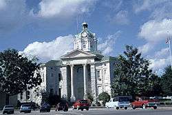 Marion County courthouse in Columbia | |
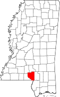 Location in the U.S. state of Mississippi | |
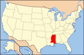 Mississippi's location in the U.S. | |
| Founded | 1811 |
| Named for | Francis Marion |
| Seat | Columbia |
| Largest city | Columbia |
| Area | |
| • Total | 549 sq mi (1,422 km2) |
| • Land | 542 sq mi (1,404 km2) |
| • Water | 6.2 sq mi (16 km2), 1.1% |
| Population | |
| • (2010) | 27,088 |
| • Density | 50/sq mi (19/km²) |
| Congressional district | 4th |
| Time zone | Central: UTC-6/-5 |
| Website |
www |
Marion County is a county located in the U.S. state of Mississippi. As of the 2010 census, the population was 27,088.[1] Its county seat is Columbia.[2] Marion County is named for American Revolutionary War guerrilla leader Francis Marion.[3]
Geography
According to the U.S. Census Bureau, the county has a total area of 549 square miles (1,420 km2), of which 542 square miles (1,400 km2) is land and 6.2 square miles (16 km2) (1.1%) is water.[4]
Major highways
 U.S. Highway 98
 Mississippi Highway 13
 Mississippi Highway 35
 Mississippi Highway 43
 Mississippi Highway 44
Adjacent counties
- Jefferson Davis County (north)
- Lamar County (east)
- Pearl River County (southeast)
- Washington Parish, Louisiana (south)
- Walthall County (west)
- Lawrence County (northwest)
Demographics
| Historical population | |||
|---|---|---|---|
| Census | Pop. | %± | |
| 1820 | 3,116 | — | |
| 1830 | 3,691 | 18.5% | |
| 1840 | 3,830 | 3.8% | |
| 1850 | 4,410 | 15.1% | |
| 1860 | 4,686 | 6.3% | |
| 1870 | 4,211 | −10.1% | |
| 1880 | 6,901 | 63.9% | |
| 1890 | 9,532 | 38.1% | |
| 1900 | 13,501 | 41.6% | |
| 1910 | 15,599 | 15.5% | |
| 1920 | 17,144 | 9.9% | |
| 1930 | 19,923 | 16.2% | |
| 1940 | 24,085 | 20.9% | |
| 1950 | 23,967 | −0.5% | |
| 1960 | 23,293 | −2.8% | |
| 1970 | 22,871 | −1.8% | |
| 1980 | 25,708 | 12.4% | |
| 1990 | 25,544 | −0.6% | |
| 2000 | 25,595 | 0.2% | |
| 2010 | 27,088 | 5.8% | |
| Est. 2015 | 25,563 | [5] | −5.6% |
| U.S. Decennial Census[6] 1790-1960[7] 1900-1990[8] 1990-2000[9] 2010-2013[1] | |||
As of the census[10] of 2000, there were 25,595 people, 9,336 households, and 6,880 families residing in the county. The population density was 47 people per square mile (18/km²). There were 10,395 housing units at an average density of 19 per square mile (7/km²). The racial makeup of the county was 66.96% White, 31.87% Black or African American, 0.23% Native American, 0.21% Asian, 0.01% Pacific Islander, 0.11% from other races, and 0.62% from two or more races. 0.62% of the population were Hispanic or Latino of any race.
There were 9,336 households out of which 34.80% had children under the age of 18 living with them, 54.00% were married couples living together, 15.60% had a female householder with no husband present, and 26.30% were non-families. 24.20% of all households were made up of individuals and 12.60% had someone living alone who was 65 years of age or older. The average household size was 2.64 and the average family size was 3.13.
In the county the population was spread out with 27.80% under the age of 18, 9.50% from 18 to 24, 26.90% from 25 to 44, 21.50% from 45 to 64, and 14.30% who were 65 years of age or older. The median age was 35 years. For every 100 females there were 93.70 males. For every 100 females age 18 and over, there were 88.80 males.
The median income for a household in the county was $24,555, and the median income for a family was $29,894. Males had a median income of $26,909 versus $17,192 for females. The per capita income for the county was $12,301. About 20.70% of families and 24.80% of the population were below the poverty line, including 32.60% of those under age 18 and 23.00% of those aged 65 or over.
Government and infrastructure
The Mississippi Department of Human Services's Division of Youth Services operated the Columbia Training School in unincorporated Marion County.[11][12]
Communities
Cities
- Columbia (county seat & only incorporated place)
Census-designated place
Unincorporated communities
- Bunker Hill
- Cheraw
- East Columbia
- Goss
- Hub
- Improve
- Jamestown
- Kokomo
- Morgantown
- Sandy Hook
Notable residents
- Earl W. Bascom (1916–1995), "Father of Modern Rodeo" and Hall of Fame cowboy; produced Marion County's first rodeo in 1935
- Charles C. Bass (1875-1975), "Father of Preventive Dentistry"; researcher in tropical medicine
- Gil Carmichael (born 1927), businessman, transportation specialist, Republican politician; native of Marion County[13]
- Charles Coleman (American football) (born 1963), American football player
See also
References
- 1 2 "State & County QuickFacts". United States Census Bureau. Retrieved September 4, 2013.
- ↑ "Find a County". National Association of Counties. Retrieved 2011-06-07.
- ↑ Gannett, Henry (1905). The Origin of Certain Place Names in the United States. U.S. Government Printing Office. p. 200.
- ↑ "2010 Census Gazetteer Files". United States Census Bureau. August 22, 2012. Retrieved November 6, 2014.
- ↑ "County Totals Dataset: Population, Population Change and Estimated Components of Population Change: April 1, 2010 to July 1, 2015". Retrieved July 2, 2016.
- ↑ "U.S. Decennial Census". United States Census Bureau. Retrieved November 6, 2014.
- ↑ "Historical Census Browser". University of Virginia Library. Retrieved November 6, 2014.
- ↑ "Population of Counties by Decennial Census: 1900 to 1990". United States Census Bureau. Retrieved November 6, 2014.
- ↑ "Census 2000 PHC-T-4. Ranking Tables for Counties: 1990 and 2000" (PDF). United States Census Bureau. Retrieved November 6, 2014.
- ↑ "American FactFinder". United States Census Bureau. Retrieved 2008-01-31.
- ↑ U.S. Census Bureau profile of Columbia, MS. Retrieved on July 21, 2010.
- ↑ "Public Appearance Calendar Governor Ronnie Musgrove For the Week of December 31, 2001". Mississippi Department of Archives and History. Retrieved on July 21, 2010. "Columbia Training School 1730 Highway 44 Columbia, MS."
- ↑ "Gilbert E. Carmichael papers" (PDF). librarymsstate.edu. Retrieved May 5, 2014.
External links
 |
Lawrence County | Jefferson Davis County | | |
| Walthall County | |
Lamar County | ||
| ||||
| | ||||
| Washington Parish, Louisiana | Pearl River County |
Municipalities and communities of Marion County, Mississippi, United States | ||
|---|---|---|
| Cities | | |
| CDP | ||
| Other unincorporated communities | ||
.svg.png)
Coordinates: 31°14′N 89°49′W / 31.23°N 89.82°W