Saint-Sulpice-de-Grimbouville
| Saint-Sulpice-de-Grimbouville | |
|---|---|
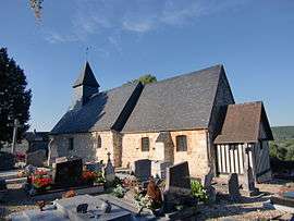 | |
 Saint-Sulpice-de-Grimbouville | |
|
Location within Normandy region  Saint-Sulpice-de-Grimbouville | |
| Coordinates: 49°22′39″N 0°26′50″E / 49.3775°N 0.4472°ECoordinates: 49°22′39″N 0°26′50″E / 49.3775°N 0.4472°E | |
| Country | France |
| Region | Normandy |
| Department | Eure |
| Arrondissement | Bernay |
| Canton | Beuzeville |
| Government | |
| • Mayor (2008–2014) | Jean-Marc Leprevost |
| Area1 | 4.32 km2 (1.67 sq mi) |
| Population (2008)2 | 178 |
| • Density | 41/km2 (110/sq mi) |
| Time zone | CET (UTC+1) |
| • Summer (DST) | CEST (UTC+2) |
| INSEE/Postal code | 27604 / 27210 |
| Elevation |
1–121 m (3.3–397.0 ft) (avg. 84 m or 276 ft) |
|
1 French Land Register data, which excludes lakes, ponds, glaciers > 1 km² (0.386 sq mi or 247 acres) and river estuaries. 2 Population without double counting: residents of multiple communes (e.g., students and military personnel) only counted once. | |
Saint-Sulpice-de-Grimbouville is a commune in the Eure department in Haute-Normandie in northern France.
Until 1991, the name of the commune was spelled Saint-Sulpice-de-Graimbouville.
Population
| Historical population | ||
|---|---|---|
| Year | Pop. | ±% |
| 1962 | 57 | — |
| 1968 | 83 | +45.6% |
| 1975 | 95 | +14.5% |
| 1982 | 136 | +43.2% |
| 1990 | 159 | +16.9% |
| 1999 | 142 | −10.7% |
| 2008 | 178 | +25.4% |
See also
References
| Wikimedia Commons has media related to Saint-Sulpice-de-Grimbouville. |
This article is issued from Wikipedia - version of the 11/15/2013. The text is available under the Creative Commons Attribution/Share Alike but additional terms may apply for the media files.