La Chapelle-Réanville
| La Chapelle-Réanville | ||
|---|---|---|
|
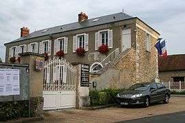
Town hall | ||
| ||
 La Chapelle-Réanville | ||
|
Location within Normandy region  La Chapelle-Réanville | ||
| Coordinates: 49°05′46″N 1°22′41″E / 49.0961°N 1.3781°ECoordinates: 49°05′46″N 1°22′41″E / 49.0961°N 1.3781°E | ||
| Country | France | |
| Region | Normandy | |
| Department | Eure | |
| Arrondissement | Évreux | |
| Canton | Vernon-Nord | |
| Intercommunality | Portes de l'Eure | |
| Government | ||
| • Mayor (2008–2014) | André Turc | |
| Area1 | 8.07 km2 (3.12 sq mi) | |
| Population (2008)2 | 1,138 | |
| • Density | 140/km2 (370/sq mi) | |
| Time zone | CET (UTC+1) | |
| • Summer (DST) | CEST (UTC+2) | |
| INSEE/Postal code | 27150 / 27950 | |
| Elevation |
59–137 m (194–449 ft) (avg. 125 m or 410 ft) | |
|
1 French Land Register data, which excludes lakes, ponds, glaciers > 1 km² (0.386 sq mi or 247 acres) and river estuaries. 2 Population without double counting: residents of multiple communes (e.g., students and military personnel) only counted once. | ||
.svg.png)
La Chapelle-Réanville is a commune in the Eure department in northern France.
Population
| Historical population | ||
|---|---|---|
| Year | Pop. | ±% |
| 1793 | 172 | — |
| 1800 | 169 | −1.7% |
| 1806 | 176 | +4.1% |
| 1821 | 173 | −1.7% |
| 1831 | 162 | −6.4% |
| 1836 | 160 | −1.2% |
| 1841 | 169 | +5.6% |
| 1846 | 339 | +100.6% |
| 1851 | 349 | +2.9% |
| 1856 | 295 | −15.5% |
| 1861 | 306 | +3.7% |
| 1866 | 294 | −3.9% |
| 1872 | 301 | +2.4% |
| 1876 | 313 | +4.0% |
| 1881 | 270 | −13.7% |
| 1886 | 267 | −1.1% |
| 1891 | 253 | −5.2% |
| 1896 | 259 | +2.4% |
| 1901 | 270 | +4.2% |
| 1906 | 275 | +1.9% |
| 1911 | 264 | −4.0% |
| 1921 | 216 | −18.2% |
| 1926 | 209 | −3.2% |
| 1931 | 205 | −1.9% |
| 1936 | 183 | −10.7% |
| 1946 | 199 | +8.7% |
| 1954 | 214 | +7.5% |
| 1962 | 185 | −13.6% |
| 1968 | 179 | −3.2% |
| 1975 | 603 | +236.9% |
| 1982 | 1,030 | +70.8% |
| 1990 | 1,031 | +0.1% |
| 1999 | 1,019 | −1.2% |
| 2008 | 1,138 | +11.7% |
See also
References
External links
| Wikimedia Commons has media related to La Chapelle-Réanville. |
This article is issued from Wikipedia - version of the 2/12/2016. The text is available under the Creative Commons Attribution/Share Alike but additional terms may apply for the media files.