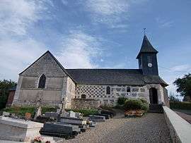
Saint-Christophe-sur-Condé
| Saint-Christophe-sur-Condé | |
|---|---|
 | |
 Saint-Christophe-sur-Condé | |
|
Location within Normandy region  Saint-Christophe-sur-Condé | |
| Coordinates: 49°17′17″N 0°36′02″E / 49.2881°N 0.6006°ECoordinates: 49°17′17″N 0°36′02″E / 49.2881°N 0.6006°E | |
| Country | France |
| Region | Normandy |
| Department | Eure |
| Arrondissement | Bernay |
| Canton | Saint-Georges-du-Vièvre |
| Government | |
| • Mayor (2008–2014) | Daniel Pincon |
| Area1 | 9 km2 (3 sq mi) |
| Population (1999)2 | 387 |
| • Density | 43/km2 (110/sq mi) |
| Time zone | CET (UTC+1) |
| • Summer (DST) | CEST (UTC+2) |
| INSEE/Postal code | 27522 / 27450 |
| Elevation |
70–144 m (230–472 ft) (avg. 134 m or 440 ft) |
|
1 French Land Register data, which excludes lakes, ponds, glaciers > 1 km² (0.386 sq mi or 247 acres) and river estuaries. 2 Population without double counting: residents of multiple communes (e.g., students and military personnel) only counted once. | |
Saint-Christophe-sur-Condé is a commune in the Eure department in Haute-Normandie in northern France.
Population
| Historical population | ||
|---|---|---|
| Year | Pop. | ±% |
| 1962 | 263 | — |
| 1968 | 304 | +15.6% |
| 1975 | 270 | −11.2% |
| 1982 | 281 | +4.1% |
| 1990 | 290 | +3.2% |
| 1999 | 297 | +2.4% |
| 2008 | 387 | +30.3% |
See also
References
| Wikimedia Commons has media related to Saint-Christophe-sur-Condé. |
This article is issued from Wikipedia - version of the 2/11/2016. The text is available under the Creative Commons Attribution/Share Alike but additional terms may apply for the media files.