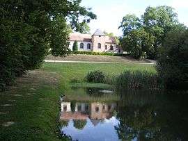
Sainte-Colombe-près-Vernon
| Sainte-Colombe-près-Vernon | ||
|---|---|---|
 | ||
| ||
 Sainte-Colombe-près-Vernon | ||
|
Location within Normandy region  Sainte-Colombe-près-Vernon | ||
| Coordinates: 49°05′50″N 1°20′21″E / 49.0972°N 1.3392°ECoordinates: 49°05′50″N 1°20′21″E / 49.0972°N 1.3392°E | ||
| Country | France | |
| Region | Normandy | |
| Department | Eure | |
| Arrondissement | Évreux | |
| Canton | Vernon-Nord | |
| Intercommunality | Les Portes de l'Eure | |
| Government | ||
| • Mayor (2008–2014) | Jean-Pierre Courel | |
| Area1 | 2.69 km2 (1.04 sq mi) | |
| Population (2008)2 | 253 | |
| • Density | 94/km2 (240/sq mi) | |
| Time zone | CET (UTC+1) | |
| • Summer (DST) | CEST (UTC+2) | |
| INSEE/Postal code | 27525 / 27950 | |
| Elevation |
85–135 m (279–443 ft) (avg. 140 m or 460 ft) | |
|
1 French Land Register data, which excludes lakes, ponds, glaciers > 1 km² (0.386 sq mi or 247 acres) and river estuaries. 2 Population without double counting: residents of multiple communes (e.g., students and military personnel) only counted once. | ||

Sainte-Colombe-près-Vernon is a commune in the Eure department in the Haute-Normandie region in northern France.
Population
| Historical population | ||
|---|---|---|
| Year | Pop. | ±% |
| 1962 | 86 | — |
| 1968 | 90 | +4.7% |
| 1975 | 102 | +13.3% |
| 1982 | 168 | +64.7% |
| 1990 | 221 | +31.5% |
| 1999 | 197 | −10.9% |
| 2008 | 253 | +28.4% |
See also
References
| Wikimedia Commons has media related to Sainte-Colombe-près-Vernon. |
This article is issued from Wikipedia - version of the 11/14/2013. The text is available under the Creative Commons Attribution/Share Alike but additional terms may apply for the media files.