Vascœuil
| Vascœuil | |
|---|---|
 | |
 Vascœuil | |
|
Location within Normandy region  Vascœuil | |
| Coordinates: 49°26′44″N 1°22′41″E / 49.4456°N 1.3781°ECoordinates: 49°26′44″N 1°22′41″E / 49.4456°N 1.3781°E | |
| Country | France |
| Region | Normandy |
| Department | Eure |
| Arrondissement | Les Andelys |
| Canton | Lyons-la-Forêt |
| Intercommunality | Lyons-la-Forêt |
| Government | |
| • Mayor (2008–2014) | Jean-Luc Moens |
| Area1 | 7.39 km2 (2.85 sq mi) |
| Population (2008)2 | 334 |
| • Density | 45/km2 (120/sq mi) |
| Time zone | CET (UTC+1) |
| • Summer (DST) | CEST (UTC+2) |
| INSEE/Postal code | 27672 / 27910 |
| Elevation |
52–171 m (171–561 ft) (avg. 57 m or 187 ft) |
|
1 French Land Register data, which excludes lakes, ponds, glaciers > 1 km² (0.386 sq mi or 247 acres) and river estuaries. 2 Population without double counting: residents of multiple communes (e.g., students and military personnel) only counted once. | |
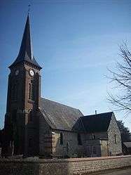
Vascœuil is a commune in the Eure department in Haute-Normandie in northern France.
Population
| Historical population | ||
|---|---|---|
| Year | Pop. | ±% |
| 1868 | 427 | — |
| 1962 | 257 | −39.8% |
| 1968 | 278 | +8.2% |
| 1975 | 271 | −2.5% |
| 1982 | 317 | +17.0% |
| 1990 | 344 | +8.5% |
| 1999 | 339 | −1.5% |
| 2008 | 334 | −1.5% |
See also
References
| Wikimedia Commons has media related to Vascœuil. |
This article is issued from Wikipedia - version of the 2/11/2016. The text is available under the Creative Commons Attribution/Share Alike but additional terms may apply for the media files.