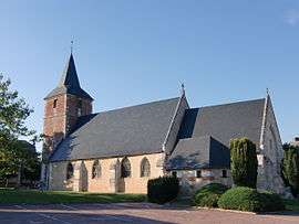
Conteville, Eure
| Conteville | |
|---|---|
 | |
 Conteville | |
|
Location within Normandy region  Conteville | |
| Coordinates: 49°25′10″N 0°23′44″E / 49.4194°N 0.3956°ECoordinates: 49°25′10″N 0°23′44″E / 49.4194°N 0.3956°E | |
| Country | France |
| Region | Normandy |
| Department | Eure |
| Arrondissement | Bernay |
| Canton | Beuzeville |
| Government | |
| • Mayor (2008–204) | Martine Lecerf |
| Area1 | 10.68 km2 (4.12 sq mi) |
| Population (2008)2 | 871 |
| • Density | 82/km2 (210/sq mi) |
| Time zone | CET (UTC+1) |
| • Summer (DST) | CEST (UTC+2) |
| INSEE/Postal code | 27169 / 27210 |
| Elevation |
0–103 m (0–338 ft) (avg. 33 m or 108 ft) |
|
1 French Land Register data, which excludes lakes, ponds, glaciers > 1 km² (0.386 sq mi or 247 acres) and river estuaries. 2 Population without double counting: residents of multiple communes (e.g., students and military personnel) only counted once. | |
Conteville is a commune in the Eure department in northern France.
Population
| Historical population | ||
|---|---|---|
| Year | Pop. | ±% |
| 1962 | 416 | — |
| 1968 | 470 | +13.0% |
| 1975 | 463 | −1.5% |
| 1982 | 580 | +25.3% |
| 1990 | 701 | +20.9% |
| 1999 | 726 | +3.6% |
| 2008 | 871 | +20.0% |
See also
References
| Wikimedia Commons has media related to Conteville (Eure). |
This article is issued from Wikipedia - version of the 8/16/2016. The text is available under the Creative Commons Attribution/Share Alike but additional terms may apply for the media files.