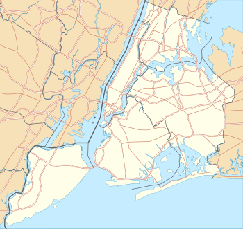
Upper East Side Historic District
|
Upper East Side Historic District | |
|
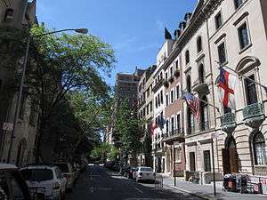
East 69th Street with its townhouses is a typical example of the sidestreets of the Upper East Side | |
   | |
| Location |
Roughly bounded by 3rd and 5th Aves., 59th and 79th Sts., (original) Portion of 17 blks adjacent to and E of the original district bet. E. 60th and E 75th Sts., (increase) New York, New York |
|---|---|
| Coordinates | 40°46′11″N 73°57′59″W / 40.76972°N 73.96639°WCoordinates: 40°46′11″N 73°57′59″W / 40.76972°N 73.96639°W |
| Built | 1862 |
| Architect | Multiple |
| Architectural style | Late 19th And 20th Century Revivals, Late Victorian |
| NRHP Reference # |
84002803[1] (original) 06000822[1] (increase) |
| Significant dates | |
| Added to NRHP | September 7, 1984 |
| Boundary increase | September 12, 2006 |
The Upper East Side Historic District is a historic district on the Upper East Side of New York City's Borough of Manhattan. The district was designated by the city in 1981.[2] It was listed on the National Register of Historic Places in 1984. Its boundaries were expanded in 2006.[1]
It includes a number of buildings individually listed on the National Register, including the Gertrude Rhinelander Waldo Mansion and the Sara Delano Roosevelt Memorial House.[1]
The Edmond J. Safra Synagogue is a 2003 building designed in an "artful synthesis of the composition, details and material palette of the Beaux-Arts style," to complement the historic buildings that surround it.[3]
References
- 1 2 3 4 National Park Service (2008-04-15). "National Register Information System". National Register of Historic Places. National Park Service.
- ↑ Upper East Side Historic District Designation Report, Vol. 1, 1981, Landmarks Preservation Commission
- ↑ In Synagogue Design, Many Paths, By DAVID W. DUNLAP, December 8, 2002, New York Times,http://query.nytimes.com/gst/fullpage.html?res=980CE7DC123BF93BA35751C1A9649C8B63&pagewanted=all
External links
![]() Media related to Upper East Side Historic District at Wikimedia Commons
Media related to Upper East Side Historic District at Wikimedia Commons
| Topics |   | |
|---|---|---|
| Lists by county |
| |
| Lists by city | ||
| Other lists | ||
| ||
This article is issued from Wikipedia - version of the 11/29/2016. The text is available under the Creative Commons Attribution/Share Alike but additional terms may apply for the media files.