Worth County, Missouri
| Worth County, Missouri | |
|---|---|
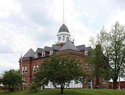 Worth County Courthouse in Grant City | |
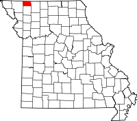 Location in the U.S. state of Missouri | |
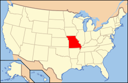 Missouri's location in the U.S. | |
| Founded | February 8, 1861 |
| Named for | William J. Worth |
| Seat | Grant City |
| Largest city | Grant City |
| Area | |
| • Total | 267 sq mi (692 km2) |
| • Land | 267 sq mi (692 km2) |
| • Water | 0.2 sq mi (1 km2), 0.08% |
| Population (est.) | |
| • (2015) | 2,057 |
| • Density | 8/sq mi (3/km²) |
| Congressional district | 6th |
| Time zone | Central: UTC-6/-5 |
| Website |
www |
Worth County is a county located in the northwestern portion of the U.S. state of Missouri. As of the 2010 census, the population was 2,171.[1] It is the smallest county in the state in population and, excepting the independent city of St. Louis, the smallest in total area. Its county seat is Grant City.[2] The county was organized February 8, 1861 and named for General William J. Worth who served in the Mexican-American War.[3]
Geography
According to the U.S. Census Bureau, the county has a total area of 267 square miles (690 km2), of which 267 square miles (690 km2) is land and 0.2 square miles (0.52 km2) (0.08%) is water.[4] It is the smallest county in Missouri by area. Iowa is located to the north of Worth County.
Adjacent counties
- Taylor County, Iowa - northwest
- Ringgold County, Iowa - northeast
- Harrison County - east
- Gentry County - south
- Nodaway County - west
Demographics
| Historical population | |||
|---|---|---|---|
| Census | Pop. | %± | |
| 1870 | 5,004 | — | |
| 1880 | 8,203 | 63.9% | |
| 1890 | 8,738 | 6.5% | |
| 1900 | 9,832 | 12.5% | |
| 1910 | 8,007 | −18.6% | |
| 1920 | 7,642 | −4.6% | |
| 1930 | 6,535 | −14.5% | |
| 1940 | 6,345 | −2.9% | |
| 1950 | 5,120 | −19.3% | |
| 1960 | 3,936 | −23.1% | |
| 1970 | 3,359 | −14.7% | |
| 1980 | 3,008 | −10.4% | |
| 1990 | 2,440 | −18.9% | |
| 2000 | 2,382 | −2.4% | |
| 2010 | 2,171 | −8.9% | |
| Est. 2015 | 2,057 | [5] | −5.3% |
| U.S. Decennial Census[6] 1790-1960[7] 1900-1990[8] 1990-2000[9] 2010-2015[1] | |||
As of the census[10] of 2000, there were 2,382 people, 1,009 households, and 677 families residing in the county. The population density was 9 people per square mile (3/km²). There were 1,245 housing units at an average density of 5 per square mile (2/km²). The racial makeup of the county was 98.99% White, 0.17% Black or African American, 0.34% Native American, 0.08% Asian, and 0.42% from two or more races. Approximately 0.29% of the population were Hispanic or Latino of any race.
There were 1,009 households out of which 28.90% had children under the age of 18 living with them, 56.40% were married couples living together, 7.70% had a female householder with no husband present, and 32.90% were non-families. 30.00% of all households were made up of individuals and 16.70% had someone living alone who was 65 years of age or older. The average household size was 2.31 and the average family size was 2.85.
In the county the population was spread out with 24.30% under the age of 18, 6.80% from 18 to 24, 23.50% from 25 to 44, 23.10% from 45 to 64, and 22.30% who were 65 years of age or older. The median age was 42 years. For every 100 females there were 96.00 males. For every 100 females age 18 and over, there were 90.60 males.
The median income for a household in the county was $27,471, and the median income for a family was $34,044. Males had a median income of $24,138 versus $17,300 for females. The per capita income for the county was $14,367. About 10.90% of families and 14.30% of the population were below the poverty line, including 18.80% of those under age 18 and 11.50% of those age 65 or over.
Education
Public schools
- Worth County R-III School District – Grant City
- Worth County Elementary School (PK-06)
- Worth County High School (07-12)
Politics
Local
The Republican Party controls politics at the local level in Worth County. Republicans hold all but six of the elected positions in the county.
| Worth County, Missouri | ||||
|---|---|---|---|---|
| Elected countywide officials | ||||
| Assessor | Carolyn J. Hardy | Republican | ||
| Circuit Clerk | Jana Findley | Democratic | ||
| County Clerk | Roberta Owens | Republican | ||
| Collector | Julie Tracy | Republican | ||
| Commissioner (Presiding) |
Ted Findley | Democratic | ||
| Commissioner (District 1) |
Regan Nonneman | Republican | ||
| Commissioner (District 2) |
Chevy Davidson | Republican | ||
| Coroner | Sharon Supinger | Democratic | ||
| Prosecuting Attorney | David A. Baird | Democratic | ||
| Public Administrator | Patsy A. Worthington | Republican | ||
| Recorder | Barbara Foland | Democratic | ||
| Sheriff | Terry Sheddrick | Democratic | ||
| Surveyor | Bob Parker | Republican | ||
| Treasurer | Linda L. Brown | Republican | ||
State
| Year | Republican | Democratic | Third Parties |
|---|---|---|---|
| 2012 | 50.14% 524 | 46.51% 486 | 3.35% 35 |
| 2008 | 48.95% 559 | 47.99% 548 | 3.06% 35 |
| 2004 | 58.43% 662 | 40.69% 461 | 0.88% 10 |
| 2000 | 49.16% 557 | 48.72% 461 | 2.12% 24 |
| 1996 | 34.11% 425 | 64.37% 802 | 1.52% 19 |
Worth County is part of the 1st district in the Missouri House of Representatives, currently held by held by Allen Andrews (R-Grant City.
| Party | Candidate | Votes | % | ± | |
|---|---|---|---|---|---|
| Republican | Allen Andrews | 640 | 83.99 | ||
| Democratic | Robert Ritterbusch | 122 | 16.01 | ||
Worth County is part of the 12th District in the Missouri Senate, currently held by Dan Hegeman (R-Cosby).
| Party | Candidate | Votes | % | ± | |
|---|---|---|---|---|---|
| Republican | Dan Hegeman | 618 | 100.00 | ||
Federal
| Party | Candidate | Votes | % | ± | |
|---|---|---|---|---|---|
| Republican | Todd Akin | 449 | 43.09 | ||
| Democratic | Claire McCaskill | 515 | 49.24 | ||
| Libertarian | Jonathan Dine | 78 | 7.49 | ||
Worth County is included in Missouri’s 6th Congressional District and is currently represented by Sam Graves (R-Tarkio) in the U.S. House of Representatives.
| Party | Candidate | Votes | % | ± | |
|---|---|---|---|---|---|
| Republican | Sam Graves | 496 | 65.87 | ||
| Democratic | Bill Hedge | 206 | 27.36 | ||
| Libertarian | Russ Lee Monchil | 51 | 6.77 | ||
| Year | Republican | Democratic | Third Parties |
|---|---|---|---|
| 2012 | '63.36% 664 | 32.54% 341 | 4.10% 43 |
| 2008 | 60.22% 707 | 36.37% 427 | 3.41% 40 |
| 2004 | 61.04% 691 | 38.52% 436 | 0.44% 5 |
| 2000 | 56.22% 651 | 37.81% 469 | 3.28% 38 |
| 1996 | 42.42% 540 | 44.93% 572 | 12.65% 161 |
Missouri Presidential Preference Primary (2008)
- Former U.S. Senator Hillary Clinton (D-New York) received more votes, a total of 171, than any candidate from either party in Worth County during the 2008 presidential primary.
| Worth County, Missouri | ||
|---|---|---|
| 2008 Republican primary in Missouri | ||
| John McCain | 73 (28.63%) | |
| Mike Huckabee | 84 (32.94%) | |
| Mitt Romney | 77 (30.20%) | |
| Ron Paul | 10 (3.92%) | |
| Worth County, Missouri | ||
|---|---|---|
| 2008 Democratic primary in Missouri | ||
| Hillary Clinton | 171 (57.97%) | |
| Barack Obama | 105 (35.59%) | |
| John Edwards (withdrawn) | 17 (5.76%) | |
Communities
See also
References
- 1 2 "State & County QuickFacts". United States Census Bureau. Retrieved September 14, 2013.
- ↑ "Find a County". National Association of Counties. Archived from the original on May 31, 2011. Retrieved 2011-06-07.
- ↑ Eaton, David Wolfe (1918). How Missouri Counties, Towns and Streams Were Named. The State Historical Society of Missouri. p. 372.
- ↑ "2010 Census Gazetteer Files". United States Census Bureau. August 22, 2012. Retrieved November 22, 2014.
- ↑ "County Totals Dataset: Population, Population Change and Estimated Components of Population Change: April 1, 2010 to July 1, 2015". Retrieved July 2, 2016.
- ↑ "U.S. Decennial Census". United States Census Bureau. Archived from the original on May 11, 2015. Retrieved November 22, 2014.
- ↑ "Historical Census Browser". University of Virginia Library. Retrieved November 22, 2014.
- ↑ "Population of Counties by Decennial Census: 1900 to 1990". United States Census Bureau. Retrieved November 22, 2014.
- ↑ "Census 2000 PHC-T-4. Ranking Tables for Counties: 1990 and 2000" (PDF). United States Census Bureau. Retrieved November 22, 2014.
- ↑ "American FactFinder". United States Census Bureau. Retrieved 2008-01-31.
External links
- Digitized 1930 Plat Book of Worth County from University of Missouri Division of Special Collections, Archives, and Rare Books]
- Official website of Worth County, Missouri.
 |
Taylor County, Iowa | Ringgold County, Iowa | | |
| Nodaway County | |
Harrison County | ||
| ||||
| | ||||
| Gentry County |
Municipalities and communities of Worth County, Missouri, United States | ||
|---|---|---|
| Cities | | |
| Villages | ||
| Townships |
| |
| Unincorporated communities | ||
Coordinates: 40°29′N 94°25′W / 40.48°N 94.42°W